Włodowice-Rzędkowice-Dzibice-Siemięrzyce-Siamoszyce-Karlin-Kromołów-Morsko-WLodowice
A cycling route starting in Włodowice, Silesian Voivodeship, Poland.
Overview
About this route
Fajna trasa ze sporą ilościa podjazdów i zjazdów (część szybka, kręta z korzeniami). Troche asfaltu, żwiru i pojawia się niestety calkiem sporo piasku.
Moim zdaniem, przez niektóre odcinki, raczej dla roweru górskiego. Mała uwaga. Na około 2 km przed zamkiem Bąkowiec w Morsku przegapiłem szlak (miałem skręcić ostro w lewo, a pojechałem prosto), co sprawiło, że musiałem około 600m na przełaj przez las prowadzić rower!- -:--
- Duration
- 58.8 km
- Distance
- 431 m
- Ascent
- 431 m
- Descent
- ---
- Avg. speed
- ---
- Avg. speed
Continue with Bikemap
Use, edit, or download this cycling route
You would like to ride Włodowice-Rzędkowice-Dzibice-Siemięrzyce-Siamoszyce-Karlin-Kromołów-Morsko-WLodowice or customize it for your own trip? Here is what you can do with this Bikemap route:
Free features
- Save this route as favorite or in collections
- Copy & plan your own version of this route
- Sync your route with Garmin or Wahoo
Premium features
Free trial for 3 days, or one-time payment. More about Bikemap Premium.
- Navigate this route on iOS & Android
- Export a GPX / KML file of this route
- Create your custom printout (try it for free)
- Download this route for offline navigation
Discover more Premium features.
Get Bikemap PremiumFrom our community
Other popular routes starting in Włodowice
- Zarki Myszkow Bobolice
- Distance
- 48.6 km
- Ascent
- 295 m
- Descent
- 296 m
- Location
- Włodowice, Silesian Voivodeship, Poland
- 2022 Jura – Etap 3
- Distance
- 56.9 km
- Ascent
- 471 m
- Descent
- 566 m
- Location
- Włodowice, Silesian Voivodeship, Poland
- Trasa nr 3 - Żarki
- Distance
- 15.8 km
- Ascent
- 165 m
- Descent
- 177 m
- Location
- Włodowice, Silesian Voivodeship, Poland
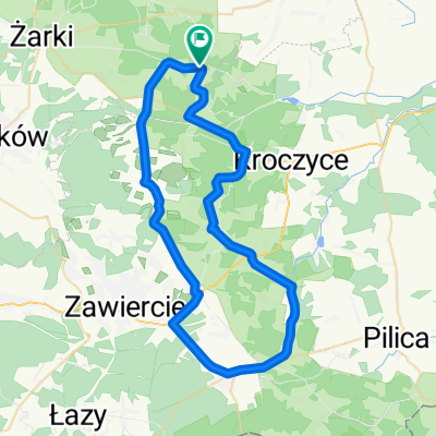
- Częstochowa - dzień 3
- Distance
- 54.2 km
- Ascent
- 248 m
- Descent
- 337 m
- Location
- Włodowice, Silesian Voivodeship, Poland
- Trasa nr 1 - Niegowa
- Distance
- 14.3 km
- Ascent
- 154 m
- Descent
- 163 m
- Location
- Włodowice, Silesian Voivodeship, Poland
- Część Orlich Gniazd
- Distance
- 80.1 km
- Ascent
- 1,243 m
- Descent
- 1,248 m
- Location
- Włodowice, Silesian Voivodeship, Poland
- Mirów-Niegowa-Złoty Potok-Ostrężnik-Trzebniów-Moczydło-Łutowiec-Mirów
- Distance
- 33.8 km
- Ascent
- 378 m
- Descent
- 378 m
- Location
- Włodowice, Silesian Voivodeship, Poland
- Wyprawa 1 Orle Gniazda
- Distance
- 16.2 km
- Ascent
- 162 m
- Descent
- 159 m
- Location
- Włodowice, Silesian Voivodeship, Poland
Open it in the app