

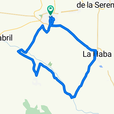
Madrigalejo
A cycling route starting in Don Benito, Extremadura, Spain.
Overview
About this route
Perfil llano
- -:--
- Duration
- 105.6 km
- Distance
- 153 m
- Ascent
- 188 m
- Descent
- ---
- Avg. speed
- ---
- Max. altitude
Route quality
Waytypes & surfaces along the route
Waytypes
Access road
33.8 km
(32 %)
Cycleway
24.3 km
(23 %)
Surfaces
Paved
52.8 km
(50 %)
Paved (undefined)
26.4 km
(25 %)
Asphalt
26.4 km
(25 %)
Undefined
52.8 km
(50 %)
Continue with Bikemap
Use, edit, or download this cycling route
You would like to ride Madrigalejo or customize it for your own trip? Here is what you can do with this Bikemap route:
Free features
- Save this route as favorite or in collections
- Copy & plan your own version of this route
- Split it into stages to create a multi-day tour
- Sync your route with Garmin or Wahoo
Premium features
Free trial for 3 days, or one-time payment. More about Bikemap Premium.
- Navigate this route on iOS & Android
- Export a GPX / KML file of this route
- Create your custom printout (try it for free)
- Download this route for offline navigation
Discover more Premium features.
Get Bikemap PremiumFrom our community
Other popular routes starting in Don Benito
 Paliza para empezar
- Distance
- 31.5 km
- Ascent
- 271 m
- Descent
- 245 m
- Location
- Don Benito, Extremadura, Spain

 De Don Benito a Santa Cruz de la Sierra por Herguijuela
- Distance
- 117.7 km
- Ascent
- 407 m
- Descent
- 416 m
- Location
- Don Benito, Extremadura, Spain
 Magacela-Camino REal
- Distance
- 70.2 km
- Ascent
- 491 m
- Descent
- 498 m
- Location
- Don Benito, Extremadura, Spain
 Mengabril, Medellin
- Distance
- 31.1 km
- Ascent
- 60 m
- Descent
- 77 m
- Location
- Don Benito, Extremadura, Spain
 De Calle Ibor 29, Don Benito a Calle Ibor 29, Don Benito
- Distance
- 26.4 km
- Ascent
- 174 m
- Descent
- 173 m
- Location
- Don Benito, Extremadura, Spain
 De Don Benito a Santa Cruz de la Sierra por Herguijuela
- Distance
- 119.4 km
- Ascent
- 359 m
- Descent
- 368 m
- Location
- Don Benito, Extremadura, Spain
Open it in the app