

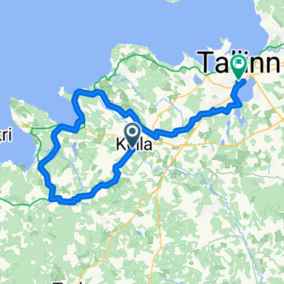
Valingu - Tallinn
A cycling route starting in Keila, Harju, Estonia.
Overview
About this route
Leisurly route through smaller paved roads and forest roads.
- -:--
- Duration
- 36.7 km
- Distance
- 81 m
- Ascent
- 102 m
- Descent
- ---
- Avg. speed
- ---
- Max. altitude
Continue with Bikemap
Use, edit, or download this cycling route
You would like to ride Valingu - Tallinn or customize it for your own trip? Here is what you can do with this Bikemap route:
Free features
- Save this route as favorite or in collections
- Copy & plan your own version of this route
- Sync your route with Garmin or Wahoo
Premium features
Free trial for 3 days, or one-time payment. More about Bikemap Premium.
- Navigate this route on iOS & Android
- Export a GPX / KML file of this route
- Create your custom printout (try it for free)
- Download this route for offline navigation
Discover more Premium features.
Get Bikemap PremiumFrom our community
Other popular routes starting in Keila
 Keila to Beach Short
- Distance
- 28.9 km
- Ascent
- 66 m
- Descent
- 75 m
- Location
- Keila, Harju, Estonia
 Keila to Paldiski, by dirt and gravel
- Distance
- 37.8 km
- Ascent
- 54 m
- Descent
- 84 m
- Location
- Keila, Harju, Estonia
 Vasalemma-Rummu-Paldiski
- Distance
- 25.3 km
- Ascent
- 53 m
- Descent
- 62 m
- Location
- Keila, Harju, Estonia
 Keila to Paldiski overnight
- Distance
- 92.6 km
- Ascent
- 102 m
- Descent
- 111 m
- Location
- Keila, Harju, Estonia
 Keila - Rummu - Padise
- Distance
- 36.1 km
- Ascent
- 50 m
- Descent
- 65 m
- Location
- Keila, Harju, Estonia
 Keila to Klooga Ring
- Distance
- 42.9 km
- Ascent
- 62 m
- Descent
- 74 m
- Location
- Keila, Harju, Estonia
 Keila to Paldiski overnight, route 2
- Distance
- 85.7 km
- Ascent
- 101 m
- Descent
- 110 m
- Location
- Keila, Harju, Estonia
 Keila-Laulasmaa-Laagri
- Distance
- 94.7 km
- Ascent
- 83 m
- Descent
- 92 m
- Location
- Keila, Harju, Estonia
Open it in the app