

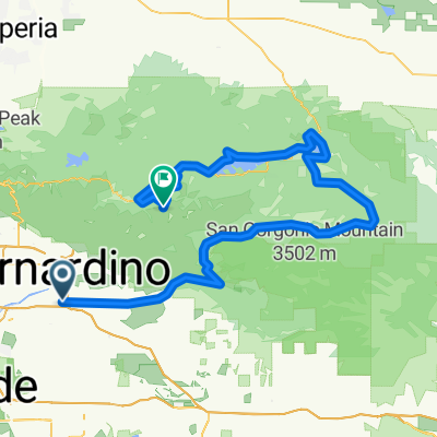
3. Redlands - Keller Peak
A cycling route starting in Redlands, California, United States.
Overview
About this route
California Valleys
- -:--
- Duration
- 136.3 km
- Distance
- 3,084 m
- Ascent
- 1,071 m
- Descent
- ---
- Avg. speed
- ---
- Max. altitude

Route quality
Waytypes & surfaces along the route
Waytypes
Quiet road
19.1 km
(14 %)
Road
8.2 km
(6 %)
Surfaces
Paved
124 km
(91 %)
Unpaved
1.4 km
(1 %)
Asphalt
124 km
(91 %)
Unpaved (undefined)
1.4 km
(1 %)
Undefined
10.9 km
(8 %)
Continue with Bikemap
Use, edit, or download this cycling route
You would like to ride 3. Redlands - Keller Peak or customize it for your own trip? Here is what you can do with this Bikemap route:
Free features
- Save this route as favorite or in collections
- Copy & plan your own version of this route
- Split it into stages to create a multi-day tour
- Sync your route with Garmin or Wahoo
Premium features
Free trial for 3 days, or one-time payment. More about Bikemap Premium.
- Navigate this route on iOS & Android
- Export a GPX / KML file of this route
- Create your custom printout (try it for free)
- Download this route for offline navigation
Discover more Premium features.
Get Bikemap PremiumFrom our community
Other popular routes starting in Redlands
 3. Redlands - Keller Peak
- Distance
- 136.3 km
- Ascent
- 3,084 m
- Descent
- 1,071 m
- Location
- Redlands, California, United States
 Redlands
- Distance
- 15.9 km
- Ascent
- 256 m
- Descent
- 256 m
- Location
- Redlands, California, United States
 1224 Magnolia Ave, Redlands to 1224 Magnolia Ave, Redlands
- Distance
- 10.7 km
- Ascent
- 73 m
- Descent
- 72 m
- Location
- Redlands, California, United States
 mentone ride
- Distance
- 14.9 km
- Ascent
- 93 m
- Descent
- 93 m
- Location
- Redlands, California, United States
 to the sports complex
- Distance
- 14.2 km
- Ascent
- 100 m
- Descent
- 100 m
- Location
- Redlands, California, United States
 Han's Workout route
- Distance
- 19 km
- Ascent
- 280 m
- Descent
- 277 m
- Location
- Redlands, California, United States
 711 W Clark St, Redlands to 714–798 W Clark St, Redlands
- Distance
- 26.5 km
- Ascent
- 543 m
- Descent
- 544 m
- Location
- Redlands, California, United States
 12 mile loop
- Distance
- 11.9 km
- Ascent
- 116 m
- Descent
- 116 m
- Location
- Redlands, California, United States
Open it in the app