Sur les routes de l'Ardèchoise (1)
- 166 km
- 2,150 m
- 2,150 m
- La Roche-de-Glun, Auvergne-Rhône-Alpes, France
A cycling route starting in La Roche-de-Glun, Auvergne-Rhône-Alpes, France.
Overview
DLF - Uzès (2 au 13/7/14)
84,67kmcreated this 11 years ago
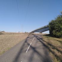
Route quality
Cycleway
33 km
(39 %)
Quiet road
26.3 km
(31 %)
Paved
56.7 km
(67 %)
Unpaved
0.8 km
(1 %)
Asphalt
56.7 km
(67 %)
Gravel
0.8 km
(1 %)
Undefined
27.1 km
(32 %)
Continue with Bikemap
You would like to ride 2014_E11_La Roche-de-Glun_Viviers or customize it for your own trip? Here is what you can do with this Bikemap route:
Free trial for 3 days, or one-time payment. More about Bikemap Premium.
Discover more Premium features.
Get Bikemap PremiumFrom our community
Open it in the app