alpen2015-tag2
- 44.2 km
- 1,232 m
- 1,701 m
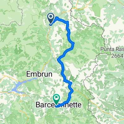
- Villar-Saint-Pancrace, Provence-Alpes-Côte d'Azur Region, France
A cycling route starting in Villar-Saint-Pancrace, Provence-Alpes-Côte d'Azur Region, France.
Overview
hills
created this 11 years ago
Route quality
Quiet road
6 km
(7 %)
Road
3.4 km
(4 %)
Paved
55.4 km
(65 %)
Unpaved
1.7 km
(2 %)
Asphalt
55.4 km
(65 %)
Gravel
1.7 km
(2 %)
Undefined
28.1 km
(33 %)
Continue with Bikemap
You would like to ride Isoardovskej okruh or customize it for your own trip? Here is what you can do with this Bikemap route:
Free trial for 3 days, or one-time payment. More about Bikemap Premium.
Discover more Premium features.
Get Bikemap PremiumFrom our community
Open it in the app