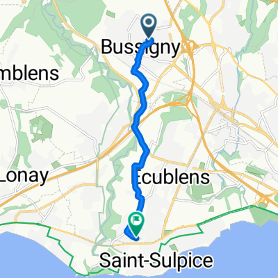
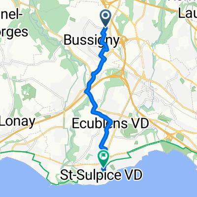
Nifff 2ème édition à vélo avec Yann et Hidéo
A cycling route starting in Bussigny, Canton of Vaud, Switzerland.
Overview
About this route
Du 11 au 13 juillet 2014
1er jour neuch, 2ème col de la Tourne et Vue des alpes, 3ème retour depuis Colombier- -:--
- Duration
- 206.5 km
- Distance
- 1,538 m
- Ascent
- 1,538 m
- Descent
- ---
- Avg. speed
- ---
- Max. altitude
Route quality
Waytypes & surfaces along the route
Waytypes
Busy road
121.3 km
(59 %)
Road
43.5 km
(21 %)
Surfaces
Paved
106.7 km
(52 %)
Unpaved
2 km
(<1 %)
Asphalt
102.5 km
(50 %)
Concrete
2.5 km
(1 %)
Continue with Bikemap
Use, edit, or download this cycling route
You would like to ride Nifff 2ème édition à vélo avec Yann et Hidéo or customize it for your own trip? Here is what you can do with this Bikemap route:
Free features
- Save this route as favorite or in collections
- Copy & plan your own version of this route
- Split it into stages to create a multi-day tour
- Sync your route with Garmin or Wahoo
Premium features
Free trial for 3 days, or one-time payment. More about Bikemap Premium.
- Navigate this route on iOS & Android
- Export a GPX / KML file of this route
- Create your custom printout (try it for free)
- Download this route for offline navigation
Discover more Premium features.
Get Bikemap PremiumFrom our community
Other popular routes starting in Bussigny
- De Chemin du Cèdre 1B, Bussigny-Lausanne à Chemin du Cèdre 1B, Bussigny-Lausanne
- Distance
- 54.4 km
- Ascent
- 802 m
- Descent
- 800 m
- Location
- Bussigny, Canton of Vaud, Switzerland
- Tour dans la grisaille avec P.O
- Distance
- 53.2 km
- Ascent
- 485 m
- Descent
- 485 m
- Location
- Bussigny, Canton of Vaud, Switzerland
- De Chemin de Villars 5, Bussigny-Lausanne à Chemin des Champs-Courbes, Ecublens VD
- Distance
- 5.3 km
- Ascent
- 41 m
- Descent
- 102 m
- Location
- Bussigny, Canton of Vaud, Switzerland
- 1ère des nombreuses sorties avec Manlio
- Distance
- 42.6 km
- Ascent
- 409 m
- Descent
- 409 m
- Location
- Bussigny, Canton of Vaud, Switzerland
- A contrevent et contretemps
- Distance
- 31.4 km
- Ascent
- 315 m
- Descent
- 315 m
- Location
- Bussigny, Canton of Vaud, Switzerland
- tour chemin campagne
- Distance
- 25.6 km
- Ascent
- 262 m
- Descent
- 261 m
- Location
- Bussigny, Canton of Vaud, Switzerland
- Ride au lieu de bosser au soleil avec PO
- Distance
- 50.2 km
- Ascent
- 461 m
- Descent
- 465 m
- Location
- Bussigny, Canton of Vaud, Switzerland
- la Chaux
- Distance
- 27.9 km
- Ascent
- 387 m
- Descent
- 400 m
- Location
- Bussigny, Canton of Vaud, Switzerland
Open it in the app