

11. Otokoks - Picture Butte
A cycling route starting in Okotoks, Alberta, Canada.
Overview
About this route
Alberta
- -:--
- Duration
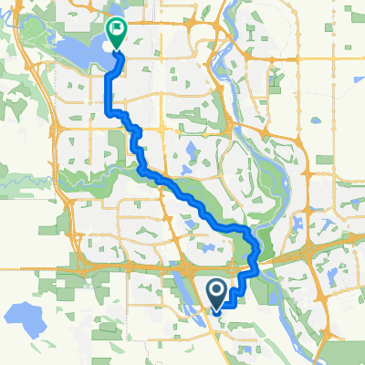
- 178.6 km
- Distance
- 346 m
- Ascent
- 526 m
- Descent
- ---
- Avg. speed
- ---
- Max. altitude

Continue with Bikemap
Use, edit, or download this cycling route
You would like to ride 11. Otokoks - Picture Butte or customize it for your own trip? Here is what you can do with this Bikemap route:
Free features
- Save this route as favorite or in collections
- Copy & plan your own version of this route
- Split it into stages to create a multi-day tour
- Sync your route with Garmin or Wahoo
Premium features
Free trial for 3 days, or one-time payment. More about Bikemap Premium.
- Navigate this route on iOS & Android
- Export a GPX / KML file of this route
- Create your custom printout (try it for free)
- Download this route for offline navigation
Discover more Premium features.
Get Bikemap PremiumFrom our community
Other popular routes starting in Okotoks
 Cranston to dogpark loop
- Distance
- 31.4 km
- Ascent
- 145 m
- Descent
- 145 m
- Location
- Okotoks, Alberta, Canada
 McKenzie Meadows Dr SE, Calgary to McKenzie Meadows Dr SE, Calgary
- Distance
- 4.5 km
- Ascent
- 29 m
- Descent
- 30 m
- Location
- Okotoks, Alberta, Canada
 Highway 2A N, Foothills No. 31 to 255001 Glenbow Rd, Rocky View County
- Distance
- 78.9 km
- Ascent
- 567 m
- Descent
- 437 m
- Location
- Okotoks, Alberta, Canada
 45 Minute SE Loop
- Distance
- 13.6 km
- Ascent
- 17 m
- Descent
- 19 m
- Location
- Okotoks, Alberta, Canada
 Okotoks Bike Path Ride
- Distance
- 35.1 km
- Ascent
- 149 m
- Descent
- 148 m
- Location
- Okotoks, Alberta, Canada
 24k Flat East
- Distance
- 24.2 km
- Ascent
- 99 m
- Descent
- 95 m
- Location
- Okotoks, Alberta, Canada
 Quick 25
- Distance
- 24.8 km
- Ascent
- 129 m
- Descent
- 129 m
- Location
- Okotoks, Alberta, Canada
 South Yyc to Heritage park
- Distance
- 21 km
- Ascent
- 125 m
- Descent
- 87 m
- Location
- Okotoks, Alberta, Canada
Open it in the app