
Elm M06 (Diana Ruh)
A cycling route starting in Veltheim, Lower Saxony, Germany.
Overview
About this route
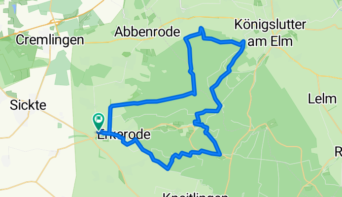
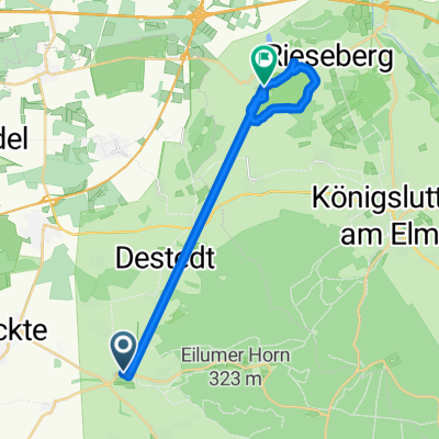
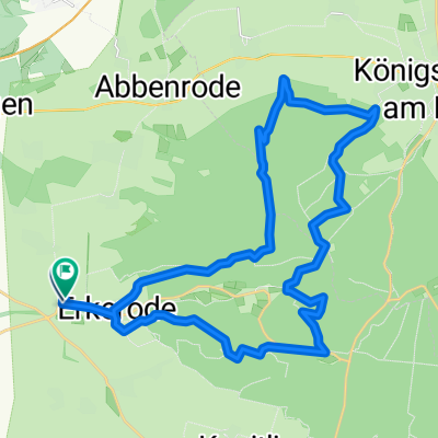
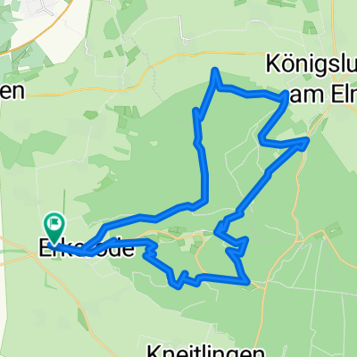
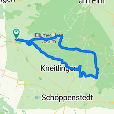
<span style="font-family: Univers; font-size: 10pt; mso-ascii-font-family: Univers; mso-hansi-font-family: Univers;">Start der Tour ist an der Gaststätte „Wegwarte“ in Lucklum. Von hier geht es in Richtung Hemkenrode und dann rechts aufwärts in den Elm. Der Weg führt uns weiter zur „Diana Ruh“ und dann am Elmrand in Richtung Königslutter. Vor Königslutter geht es wieder aufwärts, um dann ins Reitlingstal abzufahren und den letzten </span><span style="font-family: Univers; font-size: 10pt; mso-ascii-font-family: Univers; mso-hansi-font-family: Univers;">Anstieg in Richtung Eilumer Horn zu bewältigen. Ein anspruchsvoller Trail bringt uns dann an den Südrand des Elms und vorbei an der Obstbausiedlung geht es zurück zur „Wegwarte“ in Lucklum.</span>
- -:--
- Duration
- 29.7 km
- Distance
- 486 m
- Ascent
- 484 m
- Descent
- ---
- Avg. speed
- ---
- Max. altitude

Continue with Bikemap
Use, edit, or download this cycling route
You would like to ride Elm M06 (Diana Ruh) or customize it for your own trip? Here is what you can do with this Bikemap route:
Free features
- Save this route as favorite or in collections
- Copy & plan your own version of this route
- Sync your route with Garmin or Wahoo
Premium features
Free trial for 3 days, or one-time payment. More about Bikemap Premium.
- Navigate this route on iOS & Android
- Export a GPX / KML file of this route
- Create your custom printout (try it for free)
- Download this route for offline navigation
Discover more Premium features.
Get Bikemap PremiumFrom our community
Other popular routes starting in Veltheim
 Elm M06 (Diana Ruh)
- Distance
- 29.7 km
- Ascent
- 488 m
- Descent
- 485 m
- Location
- Veltheim, Lower Saxony, Germany
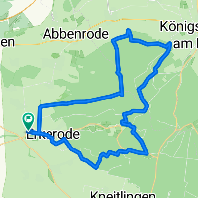
 ZW03 Lucklum-Erkerode-Eilumer Horn
- Distance
- 9.7 km
- Ascent
- 216 m
- Descent
- 191 m
- Location
- Veltheim, Lower Saxony, Germany
 Elmrunde XL
- Distance
- 51.9 km
- Ascent
- 519 m
- Descent
- 522 m
- Location
- Veltheim, Lower Saxony, Germany
 Schnelle Ausfahrt durch Königslutter am Elm
- Distance
- 17.5 km
- Ascent
- 227 m
- Descent
- 246 m
- Location
- Veltheim, Lower Saxony, Germany
 Westelm CLONED FROM ROUTE 257017
- Distance
- 29.3 km
- Ascent
- 514 m
- Descent
- 513 m
- Location
- Veltheim, Lower Saxony, Germany
 Tour im Naturpark Elm-Lappwald
- Distance
- 32.1 km
- Ascent
- 597 m
- Descent
- 595 m
- Location
- Veltheim, Lower Saxony, Germany
 Elm M06 (Diana Ruh)
- Distance
- 29.7 km
- Ascent
- 486 m
- Descent
- 484 m
- Location
- Veltheim, Lower Saxony, Germany
 Elm M03 (Toscana Tour)
- Distance
- 28.5 km
- Ascent
- 357 m
- Descent
- 353 m
- Location
- Veltheim, Lower Saxony, Germany
Open it in the app