

Etape 15 Aiguines > Villecroze
A cycling route starting in Riez, Provence-Alpes-Côte d'Azur Region, France.
Overview
About this route
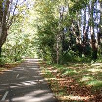
Aiguines -> Villecroze
- -:--
- Duration
- 36.3 km
- Distance
- 464 m
- Ascent
- 678 m
- Descent
- ---
- Avg. speed
- ---
- Max. altitude

Route quality
Waytypes & surfaces along the route
Waytypes
Track
4.7 km
(13 %)
Road
4 km
(11 %)
Surfaces
Paved
21.4 km
(59 %)
Unpaved
3.6 km
(10 %)
Asphalt
21.1 km
(58 %)
Ground
2.5 km
(7 %)
Continue with Bikemap
Use, edit, or download this cycling route
You would like to ride Etape 15 Aiguines > Villecroze or customize it for your own trip? Here is what you can do with this Bikemap route:
Free features
- Save this route as favorite or in collections
- Copy & plan your own version of this route
- Sync your route with Garmin or Wahoo
Premium features
Free trial for 3 days, or one-time payment. More about Bikemap Premium.
- Navigate this route on iOS & Android
- Export a GPX / KML file of this route
- Create your custom printout (try it for free)
- Download this route for offline navigation
Discover more Premium features.
Get Bikemap PremiumFrom our community
Other popular routes starting in Riez
 P40 Tour 3 - Gorges Du Verdon
- Distance
- 88.6 km
- Ascent
- 1,834 m
- Descent
- 1,834 m
- Location
- Riez, Provence-Alpes-Côte d'Azur Region, France
 Verdonschlucht
- Distance
- 96.4 km
- Ascent
- 1,649 m
- Descent
- 1,649 m
- Location
- Riez, Provence-Alpes-Côte d'Azur Region, France
 Day 7
Day 7- Distance
- 75.5 km
- Ascent
- 601 m
- Descent
- 904 m
- Location
- Riez, Provence-Alpes-Côte d'Azur Region, France
 Etapp 6 cykelresa 2016
- Distance
- 106.2 km
- Ascent
- 1,156 m
- Descent
- 1,502 m
- Location
- Riez, Provence-Alpes-Côte d'Azur Region, France
 P40 Tour 1 - Lac de Ste Croix
- Distance
- 56.5 km
- Ascent
- 670 m
- Descent
- 672 m
- Location
- Riez, Provence-Alpes-Côte d'Azur Region, France
 In den Bergen nördlich des Canyon du Verdon
- Distance
- 73.5 km
- Ascent
- 1,585 m
- Descent
- 1,546 m
- Location
- Riez, Provence-Alpes-Côte d'Azur Region, France
 Allemagne-en-Provence to Apt
- Distance
- 69.1 km
- Ascent
- 843 m
- Descent
- 1,048 m
- Location
- Riez, Provence-Alpes-Côte d'Azur Region, France
 Lac de Ste Croix
- Distance
- 57.7 km
- Ascent
- 623 m
- Descent
- 623 m
- Location
- Riez, Provence-Alpes-Côte d'Azur Region, France
Open it in the app