

hohewinde
A cycling route starting in Himmelried, Canton of Solothurn, Switzerland.
Overview
About this route
hdfgdf
- -:--
- Duration
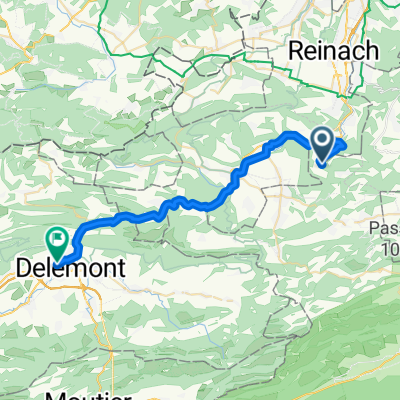
- 22.1 km
- Distance
- 911 m
- Ascent
- 911 m
- Descent
- ---
- Avg. speed
- ---
- Max. altitude
Route highlights
Points of interest along the route
Point of interest after 12.8 km
Continue with Bikemap
Use, edit, or download this cycling route
You would like to ride hohewinde or customize it for your own trip? Here is what you can do with this Bikemap route:
Free features
- Save this route as favorite or in collections
- Copy & plan your own version of this route
- Sync your route with Garmin or Wahoo
Premium features
Free trial for 3 days, or one-time payment. More about Bikemap Premium.
- Navigate this route on iOS & Android
- Export a GPX / KML file of this route
- Create your custom printout (try it for free)
- Download this route for offline navigation
Discover more Premium features.
Get Bikemap PremiumFrom our community
Other popular routes starting in Himmelried
 Eigenhof 33, Seewen nach Krummackerweg 268, Himmelried
- Distance
- 3.3 km
- Ascent
- 143 m
- Descent
- 69 m
- Location
- Himmelried, Canton of Solothurn, Switzerland
 Himmelried Pratteln Weil
- Distance
- 41.4 km
- Ascent
- 326 m
- Descent
- 721 m
- Location
- Himmelried, Canton of Solothurn, Switzerland
 Himmelreich Weil
- Distance
- 34.2 km
- Ascent
- 291 m
- Descent
- 683 m
- Location
- Himmelried, Canton of Solothurn, Switzerland
 Grellingerstrasse, Himmelried nach Rue de Fer 10, Delémont
- Distance
- 29.8 km
- Ascent
- 457 m
- Descent
- 528 m
- Location
- Himmelried, Canton of Solothurn, Switzerland
 Nunningen - Bad Zurzach
- Distance
- 84.2 km
- Ascent
- 326 m
- Descent
- 558 m
- Location
- Himmelried, Canton of Solothurn, Switzerland
 Krummackerweg 268, Himmelried nach Krummackerweg 268, Himmelried
- Distance
- 9.5 km
- Ascent
- 255 m
- Descent
- 259 m
- Location
- Himmelried, Canton of Solothurn, Switzerland
 hohewinde
- Distance
- 22.1 km
- Ascent
- 911 m
- Descent
- 911 m
- Location
- Himmelried, Canton of Solothurn, Switzerland
 Eichelbergstrasse 6B, Nunningen nach Place de la Gare 12, Delsberg
- Distance
- 59.5 km
- Ascent
- 975 m
- Descent
- 1,135 m
- Location
- Himmelried, Canton of Solothurn, Switzerland
Open it in the app