
Tramin-Montiggler Seen
A cycling route starting in Termeno, Trentino-Alto Adige, Italy.
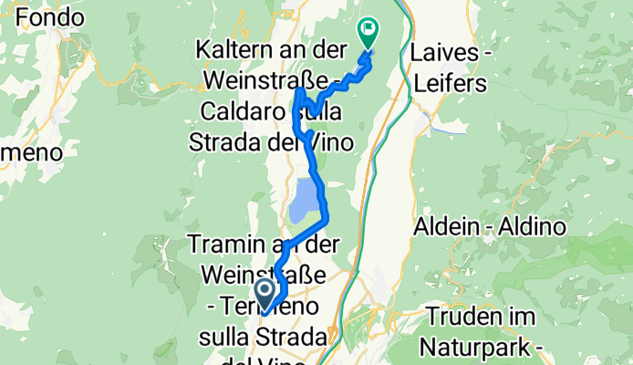
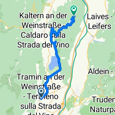
Overview
About this route
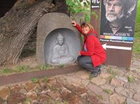
Wunderbare Tour, landschaftlich top, teilweise längere Anstiege.
Für wärme Tage gut geeignet, da längere Waldabschnitte und vielfältige Bademöglichkeiten.- -:--
- Duration
- 16.9 km
- Distance
- 354 m
- Ascent
- 81 m
- Descent
- ---
- Avg. speed
- ---
- Max. altitude
Continue with Bikemap
Use, edit, or download this cycling route
You would like to ride Tramin-Montiggler Seen or customize it for your own trip? Here is what you can do with this Bikemap route:
Free features
- Save this route as favorite or in collections
- Copy & plan your own version of this route
- Sync your route with Garmin or Wahoo
Premium features
Free trial for 3 days, or one-time payment. More about Bikemap Premium.
- Navigate this route on iOS & Android
- Export a GPX / KML file of this route
- Create your custom printout (try it for free)
- Download this route for offline navigation
Discover more Premium features.
Get Bikemap PremiumFrom our community
Other popular routes starting in Termeno
 Traminer Hof - Zur Brücke
- Distance
- 14 km
- Ascent
- 19 m
- Descent
- 56 m
- Location
- Termeno, Trentino-Alto Adige, Italy
 Tramin-Montiggler Seen
- Distance
- 16.9 km
- Ascent
- 354 m
- Descent
- 81 m
- Location
- Termeno, Trentino-Alto Adige, Italy
 Tramin-Gampenpass-Mendelpass
- Distance
- 107.7 km
- Ascent
- 1,861 m
- Descent
- 1,861 m
- Location
- Termeno, Trentino-Alto Adige, Italy
 neumarkt Riva del Garda
- Distance
- 92.2 km
- Ascent
- 1,299 m
- Descent
- 1,243 m
- Location
- Termeno, Trentino-Alto Adige, Italy
 Mendelrunde
- Distance
- 107.6 km
- Ascent
- 2,250 m
- Descent
- 2,279 m
- Location
- Termeno, Trentino-Alto Adige, Italy
 RSCN - Tramin - Cles
- Distance
- 97.2 km
- Ascent
- 1,496 m
- Descent
- 1,496 m
- Location
- Termeno, Trentino-Alto Adige, Italy
 Weinstrasse 138–142, Tramin an der Weinstraße nach Via Monticolo 57, Eppan an der Weinstrasse
- Distance
- 13.2 km
- Ascent
- 474 m
- Descent
- 231 m
- Location
- Termeno, Trentino-Alto Adige, Italy
 Auffahrt zum Lenzenhof
- Distance
- 7.9 km
- Ascent
- 591 m
- Descent
- 76 m
- Location
- Termeno, Trentino-Alto Adige, Italy
Open it in the app