

PN-Umgebung
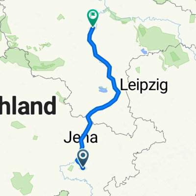
A cycling route starting in Pößneck, Thuringia, Germany.
Overview
About this route
PN-Öpitz-Krölpa-Tranroda-Herschdorf-PN
Start/Ende: Parkplatz Orlamünder Str.
- -:--
- Duration
- 13.2 km
- Distance
- 176 m
- Ascent
- 169 m
- Descent
- ---
- Avg. speed
- ---
- Max. altitude
Route highlights
Points of interest along the route
Point of interest after 12.9 km
PN-Krölpa-Tranroda-Herschdorf
Continue with Bikemap
Use, edit, or download this cycling route
You would like to ride PN-Umgebung or customize it for your own trip? Here is what you can do with this Bikemap route:
Free features
- Save this route as favorite or in collections
- Copy & plan your own version of this route
- Sync your route with Garmin or Wahoo
Premium features
Free trial for 3 days, or one-time payment. More about Bikemap Premium.
- Navigate this route on iOS & Android
- Export a GPX / KML file of this route
- Create your custom printout (try it for free)
- Download this route for offline navigation
Discover more Premium features.
Get Bikemap PremiumFrom our community
Other popular routes starting in Pößneck
 PN-Umgebung
- Distance
- 13.2 km
- Ascent
- 176 m
- Descent
- 169 m
- Location
- Pößneck, Thuringia, Germany
 2022-07-10: ADFC SRT II
- Distance
- 80.6 km
- Ascent
- 811 m
- Descent
- 813 m
- Location
- Pößneck, Thuringia, Germany
 Bertolt-Brecht-Straße 16, Pößneck nach Bertolt-Brecht-Straße 16, Pößneck
- Distance
- 29.1 km
- Ascent
- 184 m
- Descent
- 239 m
- Location
- Pößneck, Thuringia, Germany
 Milchtankstelle Oberwellenborn
- Distance
- 9.9 km
- Ascent
- 83 m
- Descent
- 43 m
- Location
- Pößneck, Thuringia, Germany
 Saale-Radweg Pößneck-Bernburg
- Distance
- 153.9 km
- Ascent
- 460 m
- Descent
- 611 m
- Location
- Pößneck, Thuringia, Germany
 Pößneck Radfahren
- Distance
- 11.6 km
- Ascent
- 112 m
- Descent
- 127 m
- Location
- Pößneck, Thuringia, Germany
 Recovered Route
- Distance
- 0.4 km
- Ascent
- 0 m
- Descent
- 0 m
- Location
- Pößneck, Thuringia, Germany
 Pößneck nach Zeitz
- Distance
- 84.2 km
- Ascent
- 809 m
- Descent
- 830 m
- Location
- Pößneck, Thuringia, Germany
Open it in the app