
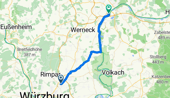
Estenfeld - Schweinfurt
A cycling route starting in Estenfeld, Bavaria, Germany.
Overview
About this route
- -:--
- Duration
- 32.6 km
- Distance
- 134 m
- Ascent
- 184 m
- Descent
- ---
- Avg. speed
- ---
- Max. altitude
Continue with Bikemap
Use, edit, or download this cycling route
You would like to ride Estenfeld - Schweinfurt or customize it for your own trip? Here is what you can do with this Bikemap route:
Free features
- Save this route as favorite or in collections
- Copy & plan your own version of this route
- Sync your route with Garmin or Wahoo
Premium features
Free trial for 3 days, or one-time payment. More about Bikemap Premium.
- Navigate this route on iOS & Android
- Export a GPX / KML file of this route
- Create your custom printout (try it for free)
- Download this route for offline navigation
Discover more Premium features.
Get Bikemap PremiumFrom our community
Other popular routes starting in Estenfeld
 Estenfeld-Dettelbach-KT-Wü
- Distance
- 43.2 km
- Ascent
- 307 m
- Descent
- 294 m
- Location
- Estenfeld, Bavaria, Germany
 Estenfeld - Schweinfurt
- Distance
- 32.6 km
- Ascent
- 134 m
- Descent
- 184 m
- Location
- Estenfeld, Bavaria, Germany
 Schnelle Radrunde von Mühlhausen nach Würzburg
- Distance
- 6.5 km
- Ascent
- 15 m
- Descent
- 94 m
- Location
- Estenfeld, Bavaria, Germany
 Main-Werra-Wern-Main
- Distance
- 92.6 km
- Ascent
- 363 m
- Descent
- 364 m
- Location
- Estenfeld, Bavaria, Germany
 20170316_175511.gpx
- Distance
- 12.7 km
- Ascent
- 170 m
- Descent
- 164 m
- Location
- Estenfeld, Bavaria, Germany
 Main Traum
- Distance
- 87.8 km
- Ascent
- 302 m
- Descent
- 302 m
- Location
- Estenfeld, Bavaria, Germany
 Main Traumtour
- Distance
- 78.8 km
- Ascent
- 233 m
- Descent
- 233 m
- Location
- Estenfeld, Bavaria, Germany
 Estenfeld - Fladungen / Rhön
- Distance
- 102.3 km
- Ascent
- 503 m
- Descent
- 312 m
- Location
- Estenfeld, Bavaria, Germany
Open it in the app