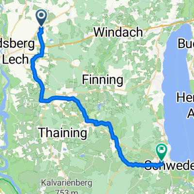
Laufstrecke Penzing Triathlon 2014
A cycling route starting in Penzing, Bavaria, Germany.
Overview
About this route
Running course Penzing Triathlon 2014
no guarantee
- -:--
- Duration
- 5 km
- Distance
- 50 m
- Ascent
- 46 m
- Descent
- ---
- Avg. speed
- ---
- Max. altitude
Route quality
Waytypes & surfaces along the route
Waytypes
Track
4.1 km
(82 %)
Quiet road
0.9 km
(18 %)
Surfaces
Paved
0.8 km
(16 %)
Unpaved
4.1 km
(82 %)
Gravel
2.8 km
(56 %)
Loose gravel
0.9 km
(19 %)
Continue with Bikemap
Use, edit, or download this cycling route
You would like to ride Laufstrecke Penzing Triathlon 2014 or customize it for your own trip? Here is what you can do with this Bikemap route:
Free features
- Save this route as favorite or in collections
- Copy & plan your own version of this route
- Sync your route with Garmin or Wahoo
Premium features
Free trial for 3 days, or one-time payment. More about Bikemap Premium.
- Navigate this route on iOS & Android
- Export a GPX / KML file of this route
- Create your custom printout (try it for free)
- Download this route for offline navigation
Discover more Premium features.
Get Bikemap PremiumFrom our community
Other popular routes starting in Penzing
- Laufstrecke Penzing Triathlon 2014
- Distance
- 5 km
- Ascent
- 50 m
- Descent
- 46 m
- Location
- Penzing, Bavaria, Germany
- Penzing - Hofstetten Rundkurs
- Distance
- 16.9 km
- Ascent
- 107 m
- Descent
- 108 m
- Location
- Penzing, Bavaria, Germany
- Gemütliche Route in Penzing
- Distance
- 0.1 km
- Ascent
- 0 m
- Descent
- 0 m
- Location
- Penzing, Bavaria, Germany
- Ramsachrunde
- Distance
- 16.3 km
- Ascent
- 155 m
- Descent
- 160 m
- Location
- Penzing, Bavaria, Germany
- LechRunde
- Distance
- 37.8 km
- Ascent
- 215 m
- Descent
- 215 m
- Location
- Penzing, Bavaria, Germany
- D Penzig Lech
- Distance
- 13.3 km
- Ascent
- 84 m
- Descent
- 98 m
- Location
- Penzing, Bavaria, Germany
- rund um den Fliegerhorst
- Distance
- 13.7 km
- Ascent
- 28 m
- Descent
- 28 m
- Location
- Penzing, Bavaria, Germany
- LTG 61 - Kaltenberg - LTG 61
- Distance
- 30.2 km
- Ascent
- 244 m
- Descent
- 244 m
- Location
- Penzing, Bavaria, Germany
Open it in the app