

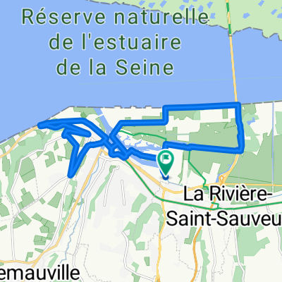
Honfleur - Louviers 190 km
A cycling route starting in La Rivière-Saint-Sauveur, Normandy, France.
Overview
About this route
Honfleur
Etretat
Louviers
- -:--
- Duration
- 181.6 km
- Distance
- 639 m
- Ascent
- 617 m
- Descent
- ---
- Avg. speed
- ---
- Max. altitude

Route quality
Waytypes & surfaces along the route
Waytypes
Road
41.8 km
(23 %)
Quiet road
14.5 km
(8 %)
Surfaces
Paved
132.5 km
(73 %)
Asphalt
132.5 km
(73 %)
Undefined
49 km
(27 %)
Continue with Bikemap
Use, edit, or download this cycling route
You would like to ride Honfleur - Louviers 190 km or customize it for your own trip? Here is what you can do with this Bikemap route:
Free features
- Save this route as favorite or in collections
- Copy & plan your own version of this route
- Split it into stages to create a multi-day tour
- Sync your route with Garmin or Wahoo
Premium features
Free trial for 3 days, or one-time payment. More about Bikemap Premium.
- Navigate this route on iOS & Android
- Export a GPX / KML file of this route
- Create your custom printout (try it for free)
- Download this route for offline navigation
Discover more Premium features.
Get Bikemap PremiumFrom our community
Other popular routes starting in La Rivière-Saint-Sauveur
 Demi Marathon Le Havre
- Distance
- 20.5 km
- Ascent
- 18 m
- Descent
- 29 m
- Location
- La Rivière-Saint-Sauveur, Normandy, France
 Honfleur - Mons
- Distance
- 468.4 km
- Ascent
- 2,690 m
- Descent
- 2,653 m
- Location
- La Rivière-Saint-Sauveur, Normandy, France
 Honfleur 1 17.1
- Distance
- 16.8 km
- Ascent
- 205 m
- Descent
- 206 m
- Location
- La Rivière-Saint-Sauveur, Normandy, France
 Honfleur - Val de Reuil 150 km
- Distance
- 149.6 km
- Ascent
- 726 m
- Descent
- 719 m
- Location
- La Rivière-Saint-Sauveur, Normandy, France
 normandie
- Distance
- 48.1 km
- Ascent
- 532 m
- Descent
- 536 m
- Location
- La Rivière-Saint-Sauveur, Normandy, France
 Velofrancette 2023
- Distance
- 495.3 km
- Ascent
- 2,648 m
- Descent
- 2,613 m
- Location
- La Rivière-Saint-Sauveur, Normandy, France
 Rue Saint Clair 823, La Rivière-Saint-Sauveur naar Vire
- Distance
- 136.1 km
- Ascent
- 1,512 m
- Descent
- 1,348 m
- Location
- La Rivière-Saint-Sauveur, Normandy, France
 Honfleur - Chatillon 213km
- Distance
- 212.9 km
- Ascent
- 504 m
- Descent
- 408 m
- Location
- La Rivière-Saint-Sauveur, Normandy, France
Open it in the app