Marktplatz nach Kornmarkt 1A
- 158.6 km
- 1,150 m
- 1,256 m
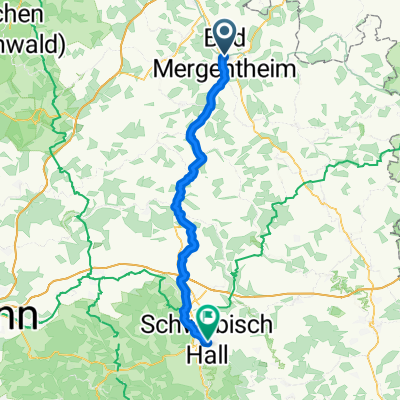
- Bad Mergentheim, Baden-Wurttemberg, Germany
A cycling route starting in Bad Mergentheim, Baden-Wurttemberg, Germany.
Overview
Bad Mergentheim - Markelsheim - Pfitzingen - Niederstetten - Spielbach - Leutzenbronn - Leutzendorf - Schrozberg and back
created this 11 years ago
Route quality
Road
32 km
(41 %)
Quiet road
14.1 km
(18 %)
Paved
59.4 km
(76 %)
Asphalt
57.8 km
(74 %)
Paved (undefined)
1.6 km
(2 %)
Undefined
18.7 km
(24 %)
Continue with Bikemap
You would like to ride Taubertal - Vorbachtal - Hohenlohe or customize it for your own trip? Here is what you can do with this Bikemap route:
Free trial for 3 days, or one-time payment. More about Bikemap Premium.
Discover more Premium features.
Get Bikemap PremiumFrom our community
Open it in the app