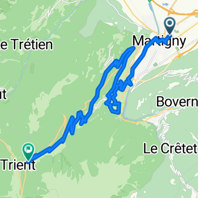
Forclaz backroad - Champex Lac - Col des Planches / Col du Lein
A cycling route starting in Martigny-Ville, Valais, Switzerland.
Overview
About this route
Forclaz backroad - Champex Lac - Col des Planches / Col du Lein
- -:--
- Duration
- 102 km
- Distance
- 3,119 m
- Ascent
- 3,118 m
- Descent
- ---
- Avg. speed
- ---
- Avg. speed
Route quality
Waytypes & surfaces along the route
Waytypes
Quiet road
36.1 km
(35 %)
Road
27.2 km
(27 %)
Surfaces
Paved
31.6 km
(31 %)
Unpaved
12 km
(12 %)
Asphalt
30.4 km
(30 %)
Unpaved (undefined)
8.9 km
(9 %)
Continue with Bikemap
Use, edit, or download this cycling route
You would like to ride Forclaz backroad - Champex Lac - Col des Planches / Col du Lein or customize it for your own trip? Here is what you can do with this Bikemap route:
Free features
- Save this route as favorite or in collections
- Copy & plan your own version of this route
- Sync your route with Garmin or Wahoo
Premium features
Free trial for 3 days, or one-time payment. More about Bikemap Premium.
- Navigate this route on iOS & Android
- Export a GPX / KML file of this route
- Create your custom printout (try it for free)
- Download this route for offline navigation
Discover more Premium features.
Get Bikemap PremiumFrom our community
Other popular routes starting in Martigny-Ville
- Belle montée, peu de voitures
- Distance
- 20.4 km
- Ascent
- 975 m
- Descent
- 38 m
- Location
- Martigny-Ville, Valais, Switzerland
- Gravel Martigny - Salvan - Finhaut - Emosson - Barberine
- Distance
- 36.2 km
- Ascent
- 2,270 m
- Descent
- 798 m
- Location
- Martigny-Ville, Valais, Switzerland
- Forclaz backroad - Champex Lac - Col des Planches / Col du Lein
- Distance
- 102 km
- Ascent
- 3,119 m
- Descent
- 3,118 m
- Location
- Martigny-Ville, Valais, Switzerland
- 1. Etappe: Martigny - Rund um den Mont Blanc nach Les Saisies
- Distance
- 100 km
- Ascent
- 2,702 m
- Descent
- 1,515 m
- Location
- Martigny-Ville, Valais, Switzerland
- [Martigny_000] Col de la Croix de Cœur.
- Distance
- 69.2 km
- Ascent
- 1,694 m
- Descent
- 1,695 m
- Location
- Martigny-Ville, Valais, Switzerland
- VR04 Martigny-St Gingolph.kml - VR04 Martigny-St Gingolph.kml_VR04 Martigny-St Gingolph
- Distance
- 60.4 km
- Ascent
- 408 m
- Descent
- 484 m
- Location
- Martigny-Ville, Valais, Switzerland
- Etape 4 : Martigny - Station de Verbier (Tour de Suisse, Aramis) 40 km
- Distance
- 40.5 km
- Ascent
- 2,293 m
- Descent
- 653 m
- Location
- Martigny-Ville, Valais, Switzerland
- Martigny nach Oberwald
- Distance
- 138.3 km
- Ascent
- 2,322 m
- Descent
- 1,411 m
- Location
- Martigny-Ville, Valais, Switzerland