

2014 Regen Donau Radweg
A cycling route starting in Cham, Bavaria, Germany.
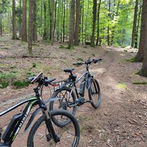
Overview
About this route
It's going to be scorching hot today, perfect for taking it easy on the Bockerlbahn
Good food in Streifenau as always
Good spot right on the Menach, clearly laid out as a drift canal
You can stroll around among the damn Indian Balsam
- -:--
- Duration
- 32.7 km
- Distance
- 234 m
- Ascent
- 152 m
- Descent
- ---
- Avg. speed
- ---
- Max. altitude
Route quality
Waytypes & surfaces along the route
Waytypes
Path
19.6 km
(60 %)
Quiet road
7.5 km
(23 %)
Surfaces
Paved
17.3 km
(53 %)
Unpaved
9.2 km
(28 %)
Asphalt
11.8 km
(36 %)
Loose gravel
8.5 km
(26 %)
Route highlights
Points of interest along the route
Point of interest after 26 km
altes e werk,guter pausenplatz AFFENHITZE!!heute
Point of interest after 30 km
KLasse Lokal...IMMER hier essen auf bockerlbahn Tour
Continue with Bikemap
Use, edit, or download this cycling route
You would like to ride 2014 Regen Donau Radweg or customize it for your own trip? Here is what you can do with this Bikemap route:
Free features
- Save this route as favorite or in collections
- Copy & plan your own version of this route
- Sync your route with Garmin or Wahoo
Premium features
Free trial for 3 days, or one-time payment. More about Bikemap Premium.
- Navigate this route on iOS & Android
- Export a GPX / KML file of this route
- Create your custom printout (try it for free)
- Download this route for offline navigation
Discover more Premium features.
Get Bikemap PremiumFrom our community
Other popular routes starting in Cham
 MTB-Tour sevensummitsCham
- Distance
- 29.3 km
- Ascent
- 560 m
- Descent
- 531 m
- Location
- Cham, Bavaria, Germany
 2015 Cham via Regen/Donau Radweg--Pfelling/Donau
- Distance
- 64 km
- Ascent
- 212 m
- Descent
- 269 m
- Location
- Cham, Bavaria, Germany
 Cham -Rötz
- Distance
- 18.9 km
- Ascent
- 285 m
- Descent
- 208 m
- Location
- Cham, Bavaria, Germany
 2015 Cham Runde
- Distance
- 10.1 km
- Ascent
- 156 m
- Descent
- 159 m
- Location
- Cham, Bavaria, Germany
 schnelle Runde
- Distance
- 17.8 km
- Ascent
- 47 m
- Descent
- 47 m
- Location
- Cham, Bavaria, Germany
 Siumava08
- Distance
- 57 km
- Ascent
- 826 m
- Descent
- 143 m
- Location
- Cham, Bavaria, Germany
 cham miltach altrandaberg harrling vilzing cham
- Distance
- 35.6 km
- Ascent
- 277 m
- Descent
- 283 m
- Location
- Cham, Bavaria, Germany
 2014 Regen Donau Radweg
- Distance
- 32.7 km
- Ascent
- 234 m
- Descent
- 152 m
- Location
- Cham, Bavaria, Germany
Open it in the app