TTCH_05
- 58.5 km
- 2,147 m
- 1,141 m
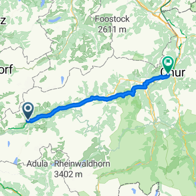
- Disentis, Grisons, Switzerland
A cycling route starting in Disentis, Grisons, Switzerland.
Overview
Szosa mażeń
created this 11 years ago
Route quality
Quiet road
4.7 km
(3 %)
Track
3.1 km
(2 %)
Paved
139.4 km
(89 %)
Unpaved
1.6 km
(1 %)
Asphalt
137.8 km
(88 %)
Concrete
1.6 km
(1 %)
Continue with Bikemap
You would like to ride Lukmanier Gottardo Oberalp or customize it for your own trip? Here is what you can do with this Bikemap route:
Free trial for 3 days, or one-time payment. More about Bikemap Premium.
Discover more Premium features.
Get Bikemap PremiumFrom our community
Open it in the app