

樂虎LOVE 兩日東進武嶺(第一天)
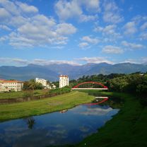
A cycling route starting in Hualien City, Taiwan, Taiwan.
Overview
About this route
太魯閣牌樓 出發
天祥 中午用餐
洛韶 補給點
新白楊 補給點
碧綠神木 補給點
觀雲山莊 第一天住宿
- -:--
- Duration
- 70.6 km
- Distance
- 4,065 m
- Ascent
- 1,722 m
- Descent
- ---
- Avg. speed
- ---
- Max. altitude

Route highlights
Points of interest along the route
\"")
Point of interest after 0 km
太魯閣牌樓
\"")
Point of interest after 18.5 km
天祥用餐
\"")
Point of interest after 33.2 km
洛韶
\"")
Point of interest after 44.7 km
新白楊
\"")
Point of interest after 58.9 km
碧綠神木
Continue with Bikemap
Use, edit, or download this cycling route
You would like to ride 樂虎LOVE 兩日東進武嶺(第一天) or customize it for your own trip? Here is what you can do with this Bikemap route:
Free features
- Save this route as favorite or in collections
- Copy & plan your own version of this route
- Sync your route with Garmin or Wahoo
Premium features
Free trial for 3 days, or one-time payment. More about Bikemap Premium.
- Navigate this route on iOS & Android
- Export a GPX / KML file of this route
- Create your custom printout (try it for free)
- Download this route for offline navigation
Discover more Premium features.
Get Bikemap PremiumFrom our community
Other popular routes starting in Hualien City
 花蓮台東7天環花東
- Distance
- 392.7 km
- Ascent
- 1,105 m
- Descent
- 1,103 m
- Location
- Hualien City, Taiwan, Taiwan
 花蓮火車站→瑞穗《193線》
- Distance
- 73.9 km
- Ascent
- 404 m
- Descent
- 331 m
- Location
- Hualien City, Taiwan, Taiwan
 Hualien Two Lakes HOOF edit
- Distance
- 67.4 km
- Ascent
- 697 m
- Descent
- 670 m
- Location
- Hualien City, Taiwan, Taiwan
 20190302美崙溪和咖小鈞吃飯
- Distance
- 19.8 km
- Ascent
- 536 m
- Descent
- 532 m
- Location
- Hualien City, Taiwan, Taiwan
 中橫之旅
中橫之旅- Distance
- 136.2 km
- Ascent
- 4,056 m
- Descent
- 3,646 m
- Location
- Hualien City, Taiwan, Taiwan
 花蓮晨騎經典路線
- Distance
- 64.5 km
- Ascent
- 1,679 m
- Descent
- 1,687 m
- Location
- Hualien City, Taiwan, Taiwan
 Hualien to Taitung
- Distance
- 193.6 km
- Ascent
- 648 m
- Descent
- 630 m
- Location
- Hualien City, Taiwan, Taiwan
 東爽第二日
東爽第二日- Distance
- 306.3 km
- Ascent
- 1,261 m
- Descent
- 1,233 m
- Location
- Hualien City, Taiwan, Taiwan
Open it in the app