

Klimroute Ardennen
A cycling route starting in Trois-Ponts, Wallonia, Belgium.
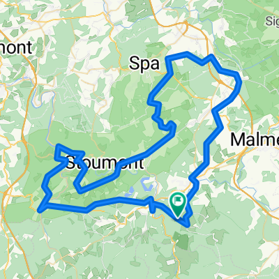
Overview
About this route
Climbing route in the Ardennes, along predominantly quiet roads. Côte d'Aisomont (4.8km / 4.7%) Côte de Werhai (3.5km / 6.6%) Kuitenbijter! Côte d'Amermont (3.4km / 5.9%) Kuitenbijter! Col du Rosier Est (3.9km / 6.1%) Côte du Maquisard (2.9km / 5%) Côte de Desnié (4.4km / 6.2%)
- -:--
- Duration
- 66.2 km
- Distance
- 1,299 m
- Ascent
- 1,302 m
- Descent
- ---
- Avg. speed
- ---
- Max. altitude

Route quality
Waytypes & surfaces along the route
Waytypes
Road
26.5 km
(40 %)
Quiet road
11.2 km
(17 %)
Surfaces
Paved
35.1 km
(53 %)
Unpaved
2 km
(3 %)
Asphalt
35.1 km
(53 %)
Ground
1.3 km
(2 %)
Route highlights
Points of interest along the route
Point of interest after 2.3 km
Côte d'Aisomont - Start
Point of interest after 7.9 km
Côte d'Aisomont - Finish
Point of interest after 10.3 km
Côte de Werhai - Start
Point of interest after 13.7 km
Côte de Werhai - Top
Point of interest after 23.1 km
Côte d' Amermont - Start
Point of interest after 26.6 km
Côte d' Amermont - Top
Point of interest after 30.8 km
Col du Rosier Est- Start
Point of interest after 35.5 km
Col du Rosier Est - Top
Point of interest after 43.7 km
Côte du Maquisard - Start
Point of interest after 46.6 km
Côte du Maquisard - Top
Point of interest after 48.9 km
Cöte de Desnie - Start
Point of interest after 52.9 km
Côte de Desnié - Top
Point of interest after 54.4 km
Xhierfomont - Start
Point of interest after 56.9 km
Xhierfomont - Top
Continue with Bikemap
Use, edit, or download this cycling route
You would like to ride Klimroute Ardennen or customize it for your own trip? Here is what you can do with this Bikemap route:
Free features
- Save this route as favorite or in collections
- Copy & plan your own version of this route
- Sync your route with Garmin or Wahoo
Premium features
Free trial for 3 days, or one-time payment. More about Bikemap Premium.
- Navigate this route on iOS & Android
- Export a GPX / KML file of this route
- Create your custom printout (try it for free)
- Download this route for offline navigation
Discover more Premium features.
Get Bikemap PremiumFrom our community
Other popular routes starting in Trois-Ponts
 01-troispont2009
- Distance
- 106.6 km
- Ascent
- 1,882 m
- Descent
- 2,036 m
- Location
- Trois-Ponts, Wallonia, Belgium
 02-troispont2009
- Distance
- 76.6 km
- Ascent
- 1,299 m
- Descent
- 1,327 m
- Location
- Trois-Ponts, Wallonia, Belgium
 De acht van Trois ponts
- Distance
- 83.7 km
- Ascent
- 1,291 m
- Descent
- 1,290 m
- Location
- Trois-Ponts, Wallonia, Belgium
 Belgien-Frühjahrstour 2016 - 3.Tag
- Distance
- 86.2 km
- Ascent
- 1,244 m
- Descent
- 1,232 m
- Location
- Trois-Ponts, Wallonia, Belgium
 Belgien-Frühjahrstour (Abschlusstour)
- Distance
- 53.8 km
- Ascent
- 1,112 m
- Descent
- 1,093 m
- Location
- Trois-Ponts, Wallonia, Belgium
 B-Ardennen-80 1500
- Distance
- 85.6 km
- Ascent
- 1,322 m
- Descent
- 1,321 m
- Location
- Trois-Ponts, Wallonia, Belgium
 Coo - Fischbach
- Distance
- 110.6 km
- Ascent
- 758 m
- Descent
- 719 m
- Location
- Trois-Ponts, Wallonia, Belgium
 Promenade des points de vue
- Distance
- 5.6 km
- Ascent
- 336 m
- Descent
- 336 m
- Location
- Trois-Ponts, Wallonia, Belgium
Open it in the app