

ASC Trainingstriathlon Swim+Bike
A cycling route starting in Konstanz, Baden-Wurttemberg, Germany.
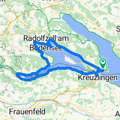
Overview
About this route
Schwimmen: Wendepunkt Schild. Gesamt 600m
1.Wechsel: etwa 120m
Rad:
Anfahrt zur Uni über Egg, dann 2 Runden Schwaketenstr-Uni-Str:
Ruppaner-Egg-Brücke-hoch zur Uni
-
Wendepunkt Einfahrt Schwaketenbad
-
Wendepunkt Unistr-Jakob-Burckhardt-Str
Wieder zur Uni hoch + Schwaketenstr.
3. Wendepunkt: wie 1.
Und wieder hoch zur Uni,runter zu Wendepunkt 2
und ab in den Hockgraben...Brücke..Egg... Ruppaner...Ziel (Überlinger Str) ca 19.6 km
- -:--
- Duration
- 20.3 km
- Distance
- 188 m
- Ascent
- 180 m
- Descent
- ---
- Avg. speed
- ---
- Max. altitude
Route quality
Waytypes & surfaces along the route
Waytypes
Quiet road
15.2 km
(75 %)
Path
2.6 km
(13 %)
Surfaces
Paved
16.6 km
(82 %)
Unpaved
0.6 km
(3 %)
Asphalt
16.4 km
(81 %)
Gravel
0.6 km
(3 %)
Route highlights
Points of interest along the route
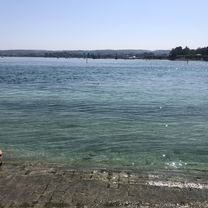
Point of interest after 0 km
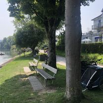
Schwimmstart
Point of interest after 0.8 km
Wechselzone,Radpark
Continue with Bikemap
Use, edit, or download this cycling route
You would like to ride ASC Trainingstriathlon Swim+Bike or customize it for your own trip? Here is what you can do with this Bikemap route:
Free features
- Save this route as favorite or in collections
- Copy & plan your own version of this route
- Sync your route with Garmin or Wahoo
Premium features
Free trial for 3 days, or one-time payment. More about Bikemap Premium.
- Navigate this route on iOS & Android
- Export a GPX / KML file of this route
- Create your custom printout (try it for free)
- Download this route for offline navigation
Discover more Premium features.
Get Bikemap PremiumFrom our community
Other popular routes starting in Konstanz
 Von Meersburg bis Lustenau
- Distance
- 73 km
- Ascent
- 252 m
- Descent
- 251 m
- Location
- Konstanz, Baden-Wurttemberg, Germany
 die gute Runde
- Distance
- 37.8 km
- Ascent
- 476 m
- Descent
- 466 m
- Location
- Konstanz, Baden-Wurttemberg, Germany
 Konstanctól Mainauig
- Distance
- 9.8 km
- Ascent
- 111 m
- Descent
- 112 m
- Location
- Konstanz, Baden-Wurttemberg, Germany
 Line-Eid-Straße, Costanza a Rhigass, Stein am Rhein
- Distance
- 29.7 km
- Ascent
- 116 m
- Descent
- 120 m
- Location
- Konstanz, Baden-Wurttemberg, Germany
 Hoheneggstraße, Costanza a Reichenaustraße, Costanza
- Distance
- 7.4 km
- Ascent
- 54 m
- Descent
- 67 m
- Location
- Konstanz, Baden-Wurttemberg, Germany
 Feierabend 4
- Distance
- 21 km
- Ascent
- 218 m
- Descent
- 187 m
- Location
- Konstanz, Baden-Wurttemberg, Germany
 Weberinnenstraße, Konstanz nach Schulgasse, Bregenz
- Distance
- 73.8 km
- Ascent
- 226 m
- Descent
- 229 m
- Location
- Konstanz, Baden-Wurttemberg, Germany
 Untersee
- Distance
- 81.6 km
- Ascent
- 550 m
- Descent
- 550 m
- Location
- Konstanz, Baden-Wurttemberg, Germany
Open it in the app