

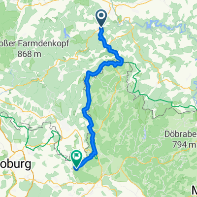
2014-07-21 Hoheneiche-Rundweg Talsperre Leibnis / Lichte
A cycling route starting in Wittgendorf, Thuringia, Germany.
Overview
About this route
wunderbare Aussichten ins Thüringer Land
- -:--
- Duration
- 39.2 km
- Distance
- 698 m
- Ascent
- 695 m
- Descent
- ---
- Avg. speed
- ---
- Max. altitude
Route quality
Waytypes & surfaces along the route
Waytypes
Access road
11.8 km
(30 %)
Busy road
11.3 km
(29 %)
Surfaces
Paved
25.7 km
(66 %)
Unpaved
9.1 km
(23 %)
Asphalt
25.6 km
(65 %)
Gravel
3.9 km
(10 %)
Continue with Bikemap
Use, edit, or download this cycling route
You would like to ride 2014-07-21 Hoheneiche-Rundweg Talsperre Leibnis / Lichte or customize it for your own trip? Here is what you can do with this Bikemap route:
Free features
- Save this route as favorite or in collections
- Copy & plan your own version of this route
- Sync your route with Garmin or Wahoo
Premium features
Free trial for 3 days, or one-time payment. More about Bikemap Premium.
- Navigate this route on iOS & Android
- Export a GPX / KML file of this route
- Create your custom printout (try it for free)
- Download this route for offline navigation
Discover more Premium features.
Get Bikemap PremiumFrom our community
Other popular routes starting in Wittgendorf
 Moderate Route
- Distance
- 16.9 km
- Ascent
- 332 m
- Descent
- 349 m
- Location
- Wittgendorf, Thuringia, Germany
 Tag 4.2 Arnsgereuth nach Mitwitz
- Distance
- 67 km
- Ascent
- 3,119 m
- Descent
- 3,467 m
- Location
- Wittgendorf, Thuringia, Germany
 2014-07-21 Hoheneiche-Rundweg Talsperre Leibnis / Lichte
- Distance
- 39.2 km
- Ascent
- 698 m
- Descent
- 695 m
- Location
- Wittgendorf, Thuringia, Germany
 2014-07-22 Hoheneiche-Unterloquitz-LohmTurm-Saalfeld-Eyba
- Distance
- 45 km
- Ascent
- 1,112 m
- Descent
- 1,112 m
- Location
- Wittgendorf, Thuringia, Germany
 Spaziergang Wittkendorf
- Distance
- 0.2 km
- Ascent
- 7 m
- Descent
- 12 m
- Location
- Wittgendorf, Thuringia, Germany
 Hoheneiche-Reichmannsdorf-Hoheneiche
- Distance
- 11.7 km
- Ascent
- 223 m
- Descent
- 223 m
- Location
- Wittgendorf, Thuringia, Germany
 Wickersdorf-Schwarzatal-Saalfeld
- Distance
- 32.8 km
- Ascent
- 275 m
- Descent
- 680 m
- Location
- Wittgendorf, Thuringia, Germany
 2014-07-23 Hoheneiche-Grafenthal-Piesau-Lichte-LeipzigerTurm
- Distance
- 51.7 km
- Ascent
- 1,185 m
- Descent
- 1,182 m
- Location
- Wittgendorf, Thuringia, Germany
Open it in the app