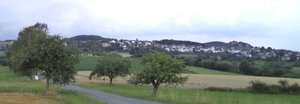
S4 Von der Lahn ins Gleiberger Land
A cycling route starting in Wetzlar, Hesse, Germany.
Overview
About this route
Die Strecke geht profiliert von der Lahn (tiefster Punkt) bis hoch nach Blasbach. Über Blasbach geht es weiter bergan zum Hofgut Bubenrod, dann an der Ortsgrenze von Königsberg entlang und von dort durch den Wald nach Bieber und nahe am 348 Meter hohen "Königstuhl" (Gemarkung Atzbach) vorbei. Dann durch das schöne Schwarzbachtal zur "Dicken Eiche". Von dort überwiegend bergab zurück zum Festplatz in Naunheim, wo sich Start und Ziel dieser Strecke befindet.
- -:--
- Duration
- 27.5 km
- Distance
- 505 m
- Ascent
- 507 m
- Descent
- ---
- Avg. speed
- ---
- Max. altitude
Route highlights
Points of interest along the route

Point of interest after 6.4 km
Blick auf Blasbach

Point of interest after 9.2 km
Little Stonehenge bei Bubenrod

Point of interest after 9.3 km
Blick in Richtung Vogelsberg ... über Bubenrod hinweg.

Point of interest after 11.6 km
Blick auf den Dünsberg (zum greifen nah) und auf Königsberg.

Point of interest after 16.2 km
Blick auf die beiden Burgen Vetzberg und Krofdorf-Gleiberg

Point of interest after 20.3 km
Hier liegt die Dicke Eiche
Continue with Bikemap
Use, edit, or download this cycling route
You would like to ride S4 Von der Lahn ins Gleiberger Land or customize it for your own trip? Here is what you can do with this Bikemap route:
Free features
- Save this route as favorite or in collections
- Copy & plan your own version of this route
- Sync your route with Garmin or Wahoo
Premium features
Free trial for 3 days, or one-time payment. More about Bikemap Premium.
- Navigate this route on iOS & Android
- Export a GPX / KML file of this route
- Create your custom printout (try it for free)
- Download this route for offline navigation
Discover more Premium features.
Get Bikemap PremiumFrom our community
Other popular routes starting in Wetzlar
 Wetzlar - Limburg
- Distance
- 69.7 km
- Ascent
- 354 m
- Descent
- 422 m
- Location
- Wetzlar, Hesse, Germany
 Wz-Marathon erste von 2 Etappen
- Distance
- 20.5 km
- Ascent
- 397 m
- Descent
- 309 m
- Location
- Wetzlar, Hesse, Germany
 Wetzlar - Allendorf - Heuchelheim - Haustädter Mühle
- Distance
- 34.2 km
- Ascent
- 325 m
- Descent
- 333 m
- Location
- Wetzlar, Hesse, Germany
 MTB-Blasbacher
- Distance
- 32 km
- Ascent
- 399 m
- Descent
- 399 m
- Location
- Wetzlar, Hesse, Germany
 Garbenheim Lahnaue Aufwärmrunde
- Distance
- 22.4 km
- Ascent
- 94 m
- Descent
- 94 m
- Location
- Wetzlar, Hesse, Germany
 50 KM rund um den Aartalsee (680HM)
- Distance
- 48.3 km
- Ascent
- 688 m
- Descent
- 688 m
- Location
- Wetzlar, Hesse, Germany
 Rund um den Stoppelberg II
- Distance
- 14.7 km
- Ascent
- 235 m
- Descent
- 235 m
- Location
- Wetzlar, Hesse, Germany
 S4 Von der Lahn ins Gleiberger Land
- Distance
- 27.5 km
- Ascent
- 505 m
- Descent
- 507 m
- Location
- Wetzlar, Hesse, Germany
Open it in the app


