

Ľubica- Ľubica, Pod lesom- Kotenhag- chata Vinná
A cycling route starting in Ľubica, Prešov Region, Slovakia.
Overview
About this route
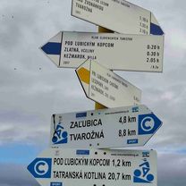
Ľubica - Ľubica, Pod lesom - flat section, 4 km Ľubica, Pod lesom - Kotenhag - gentle climb, 8 km Kotenhag - Vinná cabin - 3/4 of the way mild to moderate climb, last 1/4 steep climbs, 8 km
- -:--
- Duration
- 19.2 km
- Distance
- 614 m
- Ascent
- 33 m
- Descent
- ---
- Avg. speed
- ---
- Max. altitude
Route quality
Waytypes & surfaces along the route
Waytypes
Track
8 km
(42 %)
Quiet road
7.9 km
(41 %)
Surfaces
Paved
11.7 km
(61 %)
Asphalt
9 km
(47 %)
Concrete
2.7 km
(14 %)
Undefined
7.5 km
(39 %)
Continue with Bikemap
Use, edit, or download this cycling route
You would like to ride Ľubica- Ľubica, Pod lesom- Kotenhag- chata Vinná or customize it for your own trip? Here is what you can do with this Bikemap route:
Free features
- Save this route as favorite or in collections
- Copy & plan your own version of this route
- Sync your route with Garmin or Wahoo
Premium features
Free trial for 3 days, or one-time payment. More about Bikemap Premium.
- Navigate this route on iOS & Android
- Export a GPX / KML file of this route
- Create your custom printout (try it for free)
- Download this route for offline navigation
Discover more Premium features.
Get Bikemap PremiumFrom our community
Other popular routes starting in Ľubica
 Okruh_VO Javorina_01
- Distance
- 86.9 km
- Ascent
- 1,352 m
- Descent
- 1,351 m
- Location
- Ľubica, Prešov Region, Slovakia
 sobota
- Distance
- 19.9 km
- Ascent
- 265 m
- Descent
- 427 m
- Location
- Ľubica, Prešov Region, Slovakia
 KK - SL v1
- Distance
- 43.8 km
- Ascent
- 638 m
- Descent
- 752 m
- Location
- Ľubica, Prešov Region, Slovakia
 Ľubica- Ľubica, Pod lesom- Kotenhag- chata Vinná
- Distance
- 19.2 km
- Ascent
- 614 m
- Descent
- 33 m
- Location
- Ľubica, Prešov Region, Slovakia
 Ku ruskému táboru
- Distance
- 10.1 km
- Ascent
- 83 m
- Descent
- 141 m
- Location
- Ľubica, Prešov Region, Slovakia
 981 Levocke Vrhy 23.09.2010
- Distance
- 101.7 km
- Ascent
- 1,480 m
- Descent
- 1,480 m
- Location
- Ľubica, Prešov Region, Slovakia
 MTB Javorina
- Distance
- 4 km
- Ascent
- 398 m
- Descent
- 186 m
- Location
- Ľubica, Prešov Region, Slovakia
 Skúška
- Distance
- 0.1 km
- Ascent
- 0 m
- Descent
- 0 m
- Location
- Ľubica, Prešov Region, Slovakia
Open it in the app