


Rascafria,Valsain, cotos
- 56.2 km
- 1,804 m
- 1,804 m
- Rascafría, Madrid, Spain
A cycling route starting in Rascafría, Madrid, Spain.
Overview
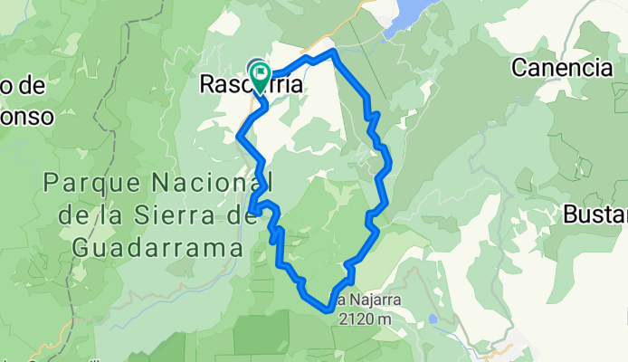
Counterclockwise route of 32.32 km in 2:30 and a total of 3:07 hours on a debut ride with Club Mammoth. Up to the Morcuera refuge, it is exactly 16 km in 1:32 with a short regrouping stop at Gollete. At the refuge, we stop for a drink and then continue taking the road towards the track leading to Canencia. After a small climb, we descend to the Majada del Cojo refuge and take the trail that goes down towards Alameda. Then we cross to the left bank of the Lozoya river and continue to Rascafría.
created this 11 years ago
Route quality
Track
28.8 km
(89 %)
Quiet road
1.9 km
(6 %)
Paved
3.9 km
(12 %)
Unpaved
25.9 km
(80 %)
Ground
25.6 km
(79 %)
Paved (undefined)
2.9 km
(9 %)
Continue with Bikemap
You would like to ride Rascafría-Purgatorio-Refugio Morcuera-Trocha Majada del Cojo 26.07.14 or customize it for your own trip? Here is what you can do with this Bikemap route:
Free trial for 3 days, or one-time payment. More about Bikemap Premium.
Discover more Premium features.
Get Bikemap PremiumFrom our community
Open it in the app


