

CB2014
CB2014#5 - La Réole Le Grand Crohot
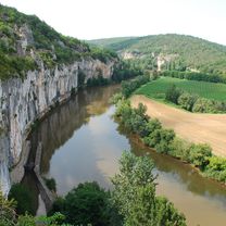
A cycling route starting in La Réole, Nouvelle-Aquitaine, France.
Overview
About this route
CB2014#5 - La Réole Le Grand Crohot
- -:--
- Duration
- 120.9 km
- Distance
- 211 m
- Ascent
- 251 m
- Descent
- ---
- Avg. speed
- ---
- Max. altitude

Part of
CB2014
7 stages
Route quality
Waytypes & surfaces along the route
Waytypes
Road
32.6 km
(27 %)
Quiet road
13.3 km
(11 %)
Surfaces
Paved
33.8 km
(28 %)
Unpaved
2.4 km
(2 %)
Asphalt
31.4 km
(26 %)
Paved (undefined)
2.4 km
(2 %)
Continue with Bikemap
Use, edit, or download this cycling route
You would like to ride CB2014#5 - La Réole Le Grand Crohot or customize it for your own trip? Here is what you can do with this Bikemap route:
Free features
- Save this route as favorite or in collections
- Copy & plan your own version of this route
- Split it into stages to create a multi-day tour
- Sync your route with Garmin or Wahoo
Premium features
Free trial for 3 days, or one-time payment. More about Bikemap Premium.
- Navigate this route on iOS & Android
- Export a GPX / KML file of this route
- Create your custom printout (try it for free)
- Download this route for offline navigation
Discover more Premium features.
Get Bikemap PremiumFrom our community
Other popular routes starting in La Réole
 La Réoule - Agen
- Distance
- 85.1 km
- Ascent
- 416 m
- Descent
- 407 m
- Location
- La Réole, Nouvelle-Aquitaine, France
 Day 5 - La Réole - St-Symphorien
- Distance
- 59.2 km
- Ascent
- 221 m
- Descent
- 171 m
- Location
- La Réole, Nouvelle-Aquitaine, France
 canal des 2 mers CR05
- Distance
- 78.9 km
- Ascent
- 640 m
- Descent
- 665 m
- Location
- La Réole, Nouvelle-Aquitaine, France
 De 13 Route d'Aillas, La Réole à Moulineau, Saint-Pierre-de-Buzet
- Distance
- 50.6 km
- Ascent
- 128 m
- Descent
- 86 m
- Location
- La Réole, Nouvelle-Aquitaine, France
 Blaignac - Mont de Marsan - Pause 1j
- Distance
- 96.6 km
- Ascent
- 257 m
- Descent
- 251 m
- Location
- La Réole, Nouvelle-Aquitaine, France
 CB2014#5 - La Réole Le Grand Crohot - Cyclable
- Distance
- 138.6 km
- Ascent
- 254 m
- Descent
- 289 m
- Location
- La Réole, Nouvelle-Aquitaine, France
 La Reole to marmande to damazan
- Distance
- 48.7 km
- Ascent
- 291 m
- Descent
- 248 m
- Location
- La Réole, Nouvelle-Aquitaine, France
 Impasse du Bois, Les Esseintes to Chemin des Fours, Haux
- Distance
- 57.6 km
- Ascent
- 591 m
- Descent
- 634 m
- Location
- La Réole, Nouvelle-Aquitaine, France
Open it in the app