

Ötzitour: St. Martin i.P. - Sölden
A cycling route starting in San Martino in Passiria, Trentino-Alto Adige, Italy.
Overview
About this route
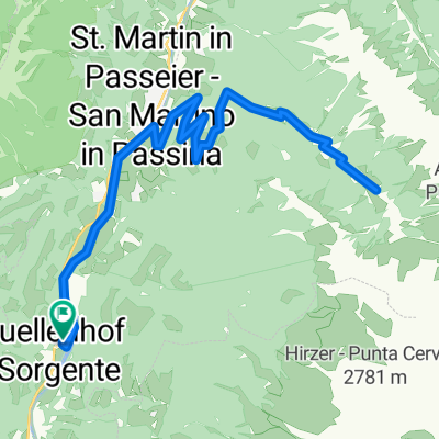
- Etappe von St. Martin im Passeiertal (Trainingslager von Jogi´s Jungs) übers Timmelsjoch nach Sölden. Dort Abbruch und Rücktransport im Auto nach Inzell wegen sturzbachartigen Regenfällen.
- -:--
- Duration
- 55.1 km
- Distance
- 1,968 m
- Ascent
- 1,203 m
- Descent
- ---
- Avg. speed
- ---
- Max. altitude

Route quality
Waytypes & surfaces along the route
Waytypes
Busy road
53.6 km
(97 %)
Pedestrian area
0.8 km
(1 %)
Surfaces
Paved
54.5 km
(99 %)
Unpaved
0.6 km
(1 %)
Asphalt
54.5 km
(99 %)
Gravel
0.4 km
(<1 %)
Continue with Bikemap
Use, edit, or download this cycling route
You would like to ride Ötzitour: St. Martin i.P. - Sölden or customize it for your own trip? Here is what you can do with this Bikemap route:
Free features
- Save this route as favorite or in collections
- Copy & plan your own version of this route
- Sync your route with Garmin or Wahoo
Premium features
Free trial for 3 days, or one-time payment. More about Bikemap Premium.
- Navigate this route on iOS & Android
- Export a GPX / KML file of this route
- Create your custom printout (try it for free)
- Download this route for offline navigation
Discover more Premium features.
Get Bikemap PremiumFrom our community
Other popular routes starting in San Martino in Passiria
 Von Saltaus nach Magdfeld
- Distance
- 18.2 km
- Ascent
- 689 m
- Descent
- 692 m
- Location
- San Martino in Passiria, Trentino-Alto Adige, Italy
 Pfandleralm
- Distance
- 23.6 km
- Ascent
- 820 m
- Descent
- 830 m
- Location
- San Martino in Passiria, Trentino-Alto Adige, Italy
 Laziner Alm
- Distance
- 55.6 km
- Ascent
- 1,360 m
- Descent
- 1,360 m
- Location
- San Martino in Passiria, Trentino-Alto Adige, Italy
 Hinterbrugg Trail ab Breiteben, Start Quellenhof
- Distance
- 25.3 km
- Ascent
- 540 m
- Descent
- 534 m
- Location
- San Martino in Passiria, Trentino-Alto Adige, Italy
 Tessellated
- Distance
- 7.8 km
- Ascent
- 395 m
- Descent
- 395 m
- Location
- San Martino in Passiria, Trentino-Alto Adige, Italy
 Fartleiser Alm
- Distance
- 27 km
- Ascent
- 975 m
- Descent
- 975 m
- Location
- San Martino in Passiria, Trentino-Alto Adige, Italy
 Ötzitour: St. Martin i.P. - Sölden
- Distance
- 55.1 km
- Ascent
- 1,968 m
- Descent
- 1,203 m
- Location
- San Martino in Passiria, Trentino-Alto Adige, Italy
 Meran
Meran- Distance
- 24.4 km
- Ascent
- 264 m
- Descent
- 265 m
- Location
- San Martino in Passiria, Trentino-Alto Adige, Italy
Open it in the app