

26072014 Aggsbach Jauerling Pöchlarn
A cycling route starting in Aggsbach, Lower Austria, Austria.
Overview
About this route
Jauerling 750hm Akku von 100 auf 48 bei 8 km Steigung 2 mal bei Fullunterstützung ansonst auto
Abfahrt zu Schnell keine Rekuperation ende bei 20 Prozent Geraden ohne Unterstützung bei ca. 30 kmh- -:--
- Duration
- 68.3 km
- Distance
- 881 m
- Ascent
- 884 m
- Descent
- ---
- Avg. speed
- ---
- Max. altitude
Route quality
Waytypes & surfaces along the route
Waytypes
Busy road
25 km
(37 %)
Road
20.3 km
(30 %)
Surfaces
Paved
58.2 km
(85 %)
Unpaved
3.2 km
(5 %)
Asphalt
57.4 km
(84 %)
Unpaved (undefined)
1.8 km
(3 %)
Continue with Bikemap
Use, edit, or download this cycling route
You would like to ride 26072014 Aggsbach Jauerling Pöchlarn or customize it for your own trip? Here is what you can do with this Bikemap route:
Free features
- Save this route as favorite or in collections
- Copy & plan your own version of this route
- Sync your route with Garmin or Wahoo
Premium features
Free trial for 3 days, or one-time payment. More about Bikemap Premium.
- Navigate this route on iOS & Android
- Export a GPX / KML file of this route
- Create your custom printout (try it for free)
- Download this route for offline navigation
Discover more Premium features.
Get Bikemap PremiumFrom our community
Other popular routes starting in Aggsbach
 Wachau TAG 2
- Distance
- 53.2 km
- Ascent
- 147 m
- Descent
- 164 m
- Location
- Aggsbach, Lower Austria, Austria
 D8_Aggsbach Markt-Viena
- Distance
- 114.8 km
- Ascent
- 156 m
- Descent
- 160 m
- Location
- Aggsbach, Lower Austria, Austria
 Aggstein-Runde
- Distance
- 20 km
- Ascent
- 650 m
- Descent
- 646 m
- Location
- Aggsbach, Lower Austria, Austria
 Aggsbach-Dorf nach Innerhörgersteig
- Distance
- 246 km
- Ascent
- 2,379 m
- Descent
- 2,082 m
- Location
- Aggsbach, Lower Austria, Austria
 26072014 Aggsbach Jauerling Pöchlarn
- Distance
- 68.3 km
- Ascent
- 881 m
- Descent
- 884 m
- Location
- Aggsbach, Lower Austria, Austria
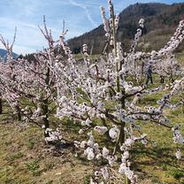 Marillenblüte in der Wachau 23.3.23
- Distance
- 54.5 km
- Ascent
- 484 m
- Descent
- 484 m
- Location
- Aggsbach, Lower Austria, Austria
 Residenz Wachau Langenlois
- Distance
- 41.3 km
- Ascent
- 313 m
- Descent
- 291 m
- Location
- Aggsbach, Lower Austria, Austria
 Long bike tour from Aggsbach - Dorf to Gemeinde Schönbühel-Aggsbach
- Distance
- 69.7 km
- Ascent
- 172 m
- Descent
- 172 m
- Location
- Aggsbach, Lower Austria, Austria
Open it in the app