

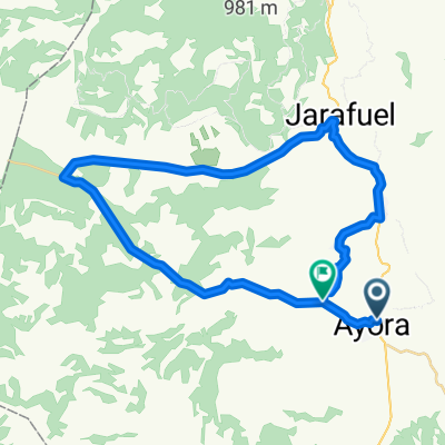
Ayora, cofrentes,campichuelo,alcala del jucar, ayora
A cycling route starting in Ayora, Valencia, Spain.
Overview
About this route
terreno variado y divertido
- -:--
- Duration
- 110.8 km
- Distance
- 1,011 m
- Ascent
- 1,009 m
- Descent
- ---
- Avg. speed
- ---
- Max. altitude
Route quality
Waytypes & surfaces along the route
Waytypes
Busy road
46.1 km
(42 %)
Access road
15.8 km
(14 %)
Surfaces
Paved
9.4 km
(8 %)
Asphalt
9.4 km
(8 %)
Undefined
101.4 km
(92 %)
Continue with Bikemap
Use, edit, or download this cycling route
You would like to ride Ayora, cofrentes,campichuelo,alcala del jucar, ayora or customize it for your own trip? Here is what you can do with this Bikemap route:
Free features
- Save this route as favorite or in collections
- Copy & plan your own version of this route
- Split it into stages to create a multi-day tour
- Sync your route with Garmin or Wahoo
Premium features
Free trial for 3 days, or one-time payment. More about Bikemap Premium.
- Navigate this route on iOS & Android
- Export a GPX / KML file of this route
- Create your custom printout (try it for free)
- Download this route for offline navigation
Discover more Premium features.
Get Bikemap PremiumFrom our community
Other popular routes starting in Ayora
 Ruta de los Castillos
- Distance
- 157.1 km
- Ascent
- 2,041 m
- Descent
- 2,041 m
- Location
- Ayora, Valencia, Spain
 De Diseminado Diseminados 146 a Calle Muelle 17, Almansa
- Distance
- 60.4 km
- Ascent
- 743 m
- Descent
- 868 m
- Location
- Ayora, Valencia, Spain
 ayora, alcala del jucar,la recueja,villavaliente,alatoz,ayora
- Distance
- 104.7 km
- Ascent
- 842 m
- Descent
- 847 m
- Location
- Ayora, Valencia, Spain
 Marcha Ayora 2015
- Distance
- 157.6 km
- Ascent
- 2,011 m
- Descent
- 2,010 m
- Location
- Ayora, Valencia, Spain
 Ayora
Ayora- Distance
- 40.3 km
- Ascent
- 494 m
- Descent
- 424 m
- Location
- Ayora, Valencia, Spain
 variante salida MARCHA AYORA (no oficial)
- Distance
- 148.8 km
- Ascent
- 1,975 m
- Descent
- 1,974 m
- Location
- Ayora, Valencia, Spain
 AYORA-ALATOZ-ALPERA-AYORA
- Distance
- 82.6 km
- Ascent
- 696 m
- Descent
- 696 m
- Location
- Ayora, Valencia, Spain
 Etapa 3
- Distance
- 168.4 km
- Ascent
- 2,307 m
- Descent
- 2,895 m
- Location
- Ayora, Valencia, Spain
Open it in the app