

Toowong, Mt Mee, Samford, Mt Nebo loop
A cycling route starting in Taringa, Queensland, Australia.
Overview
About this route
the hills in the north, drive to Toowong roundabout and ride from there to keep kms down, includes dirt road
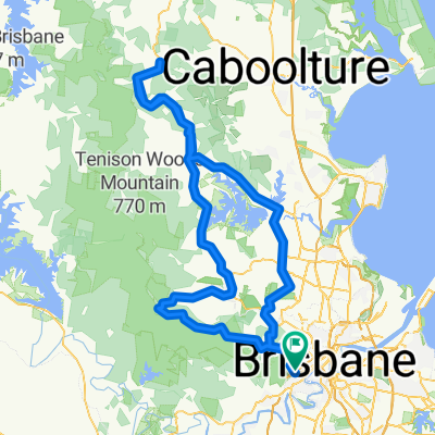
Toowong, Jinker Track, Mt Mee, Samford, Goat Track, Mt Nebo- -:--
- Duration
- 165.9 km
- Distance
- 1,274 m
- Ascent
- 1,271 m
- Descent
- ---
- Avg. speed
- ---
- Max. altitude

Route quality
Waytypes & surfaces along the route
Waytypes
Busy road
140.8 km
(85 %)
Road
7.7 km
(5 %)
Surfaces
Paved
161.4 km
(97 %)
Unpaved
2.2 km
(1 %)
Paved (undefined)
95.4 km
(58 %)
Asphalt
62.2 km
(37 %)
Continue with Bikemap
Use, edit, or download this cycling route
You would like to ride Toowong, Mt Mee, Samford, Mt Nebo loop or customize it for your own trip? Here is what you can do with this Bikemap route:
Free features
- Save this route as favorite or in collections
- Copy & plan your own version of this route
- Split it into stages to create a multi-day tour
- Sync your route with Garmin or Wahoo
Premium features
Free trial for 3 days, or one-time payment. More about Bikemap Premium.
- Navigate this route on iOS & Android
- Export a GPX / KML file of this route
- Create your custom printout (try it for free)
- Download this route for offline navigation
Discover more Premium features.
Get Bikemap PremiumFrom our community
Other popular routes starting in Taringa
 River Loop: Jindalee-Teneriffe
- Distance
- 35.4 km
- Ascent
- 179 m
- Descent
- 179 m
- Location
- Taringa, Queensland, Australia
 3 figures route
- Distance
- 67.9 km
- Ascent
- 449 m
- Descent
- 453 m
- Location
- Taringa, Queensland, Australia
 The Toowong Gateway Loop
- Distance
- 65.2 km
- Ascent
- 5,200 m
- Descent
- 5,200 m
- Location
- Taringa, Queensland, Australia
 bike tour from Mount Coot-Tha to Fig Tree Pocket
- Distance
- 18.7 km
- Ascent
- 390 m
- Descent
- 440 m
- Location
- Taringa, Queensland, Australia
 Toowong, Mt Mee, Samford, Mt Nebo loop
- Distance
- 165.9 km
- Ascent
- 1,274 m
- Descent
- 1,271 m
- Location
- Taringa, Queensland, Australia
 Mt Cootha Loop
- Distance
- 9.6 km
- Ascent
- 261 m
- Descent
- 261 m
- Location
- Taringa, Queensland, Australia
 Nebo Samford Dayboro
- Distance
- 117 km
- Ascent
- 862 m
- Descent
- 859 m
- Location
- Taringa, Queensland, Australia
 Mt Cootha finish with breakfast
- Distance
- 5.9 km
- Ascent
- 268 m
- Descent
- 272 m
- Location
- Taringa, Queensland, Australia
Open it in the app