

Rennsteigbrecher
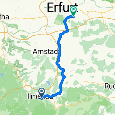
A cycling route starting in Ilmenau, Thuringia, Germany.
Overview
About this route
Ilmenau Gehren Großbreitenbach Katzhütte Neuhaus Lauscha Masserberg Tellerhammer Steinbach Frauenwald Stützerbach Ilmenau
- -:--
- Duration
- 118.3 km
- Distance
- 1,648 m
- Ascent
- 1,648 m
- Descent
- ---
- Avg. speed
- ---
- Max. altitude
Continue with Bikemap
Use, edit, or download this cycling route
You would like to ride Rennsteigbrecher or customize it for your own trip? Here is what you can do with this Bikemap route:
Free features
- Save this route as favorite or in collections
- Copy & plan your own version of this route
- Split it into stages to create a multi-day tour
- Sync your route with Garmin or Wahoo
Premium features
Free trial for 3 days, or one-time payment. More about Bikemap Premium.
- Navigate this route on iOS & Android
- Export a GPX / KML file of this route
- Create your custom printout (try it for free)
- Download this route for offline navigation
Discover more Premium features.
Get Bikemap PremiumFrom our community
Other popular routes starting in Ilmenau
 ADFC SRT 2021
- Distance
- 80.1 km
- Ascent
- 1,545 m
- Descent
- 1,546 m
- Location
- Ilmenau, Thuringia, Germany
 Wochenendtour
- Distance
- 142.1 km
- Ascent
- 921 m
- Descent
- 921 m
- Location
- Ilmenau, Thuringia, Germany
 2017-05-27: 29. Radwanderwoche in Ilmenau
- Distance
- 91.7 km
- Ascent
- 1,194 m
- Descent
- 1,190 m
- Location
- Ilmenau, Thuringia, Germany
 Ilmenau -Potsdam
- Distance
- 380 km
- Ascent
- 237 m
- Descent
- 694 m
- Location
- Ilmenau, Thuringia, Germany
 2021-05-12: Ilmenau - Singen
- Distance
- 34.4 km
- Ascent
- 414 m
- Descent
- 413 m
- Location
- Ilmenau, Thuringia, Germany
 Rennsteigbrecher
- Distance
- 118.3 km
- Ascent
- 1,648 m
- Descent
- 1,648 m
- Location
- Ilmenau, Thuringia, Germany
 2019-10-12: Rennrad-Tour
- Distance
- 71.4 km
- Ascent
- 597 m
- Descent
- 596 m
- Location
- Ilmenau, Thuringia, Germany
 2025-09-03: Ilmenau - Erfurt-SO
- Distance
- 45.6 km
- Ascent
- 288 m
- Descent
- 499 m
- Location
- Ilmenau, Thuringia, Germany
Open it in the app