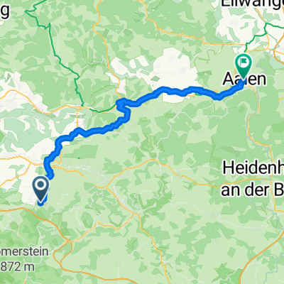
Bad Boll - Kreuzkapelle - Bosler - Bad Boll
A cycling route starting in Boll, Baden-Württemberg, Germany.
Overview
About this route
None (cloned from route 1632300)
- -:--
- Duration
- 35.6 km
- Distance
- 751 m
- Ascent
- 752 m
- Descent
- ---
- Avg. speed
- ---
- Avg. speed
Route quality
Waytypes & surfaces along the route
Waytypes
Track
21.9 km
(61 %)
Quiet road
5.7 km
(16 %)
Surfaces
Paved
14.5 km
(41 %)
Unpaved
17.9 km
(50 %)
Gravel
11.1 km
(31 %)
Asphalt
10.9 km
(31 %)
Route highlights
Points of interest along the route
Point of interest after 1.7 km
Blick auf die 3 Königsberge
Point of interest after 15 km
Blick auf Albaufstieg der A8
Continue with Bikemap
Use, edit, or download this cycling route
You would like to ride Bad Boll - Kreuzkapelle - Bosler - Bad Boll or customize it for your own trip? Here is what you can do with this Bikemap route:
Free features
- Save this route as favorite or in collections
- Copy & plan your own version of this route
- Sync your route with Garmin or Wahoo
Premium features
Free trial for 3 days, or one-time payment. More about Bikemap Premium.
- Navigate this route on iOS & Android
- Export a GPX / KML file of this route
- Create your custom printout (try it for free)
- Download this route for offline navigation
Discover more Premium features.
Get Bikemap PremiumFrom our community
Other popular routes starting in Boll
- Bad Boll - Plattfuß
- Distance
- 13.7 km
- Ascent
- 85 m
- Descent
- 183 m
- Location
- Boll, Baden-Württemberg, Germany
- Filsursprung
- Distance
- 48.1 km
- Ascent
- 528 m
- Descent
- 530 m
- Location
- Boll, Baden-Württemberg, Germany
- Bad Boll - Deutsches Haus - Gairenbuckel - Süßen
- Distance
- 38.5 km
- Ascent
- 544 m
- Descent
- 576 m
- Location
- Boll, Baden-Württemberg, Germany
- Bad Boll - Popenweiler vs. Fildern
- Distance
- 62.3 km
- Ascent
- 400 m
- Descent
- 611 m
- Location
- Boll, Baden-Württemberg, Germany
- Bad Boll - Kreuzkapelle - Bosler - Bad Boll
- Distance
- 35.6 km
- Ascent
- 751 m
- Descent
- 752 m
- Location
- Boll, Baden-Württemberg, Germany
- Bad Boll - Süßen vs. Auendorf+Hexensattel
- Distance
- 29.2 km
- Ascent
- 362 m
- Descent
- 424 m
- Location
- Boll, Baden-Württemberg, Germany
- Fuchseck
- Distance
- 27.4 km
- Ascent
- 444 m
- Descent
- 445 m
- Location
- Boll, Baden-Württemberg, Germany
- Bad Boll - Süßen über Auendorf
- Distance
- 28.2 km
- Ascent
- 539 m
- Descent
- 596 m
- Location
- Boll, Baden-Württemberg, Germany
Open it in the app