

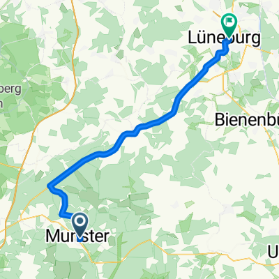
Volksradfahren 2014
A cycling route starting in Munster, Lower Saxony, Germany.
Overview
About this route
Practice area Munster North 55 km
- -:--
- Duration
- 54.7 km
- Distance
- 135 m
- Ascent
- 133 m
- Descent
- ---
- Avg. speed
- ---
- Max. altitude

Continue with Bikemap
Use, edit, or download this cycling route
You would like to ride Volksradfahren 2014 or customize it for your own trip? Here is what you can do with this Bikemap route:
Free features
- Save this route as favorite or in collections
- Copy & plan your own version of this route
- Sync your route with Garmin or Wahoo
Premium features
Free trial for 3 days, or one-time payment. More about Bikemap Premium.
- Navigate this route on iOS & Android
- Export a GPX / KML file of this route
- Create your custom printout (try it for free)
- Download this route for offline navigation
Discover more Premium features.
Get Bikemap PremiumFrom our community
Other popular routes starting in Munster
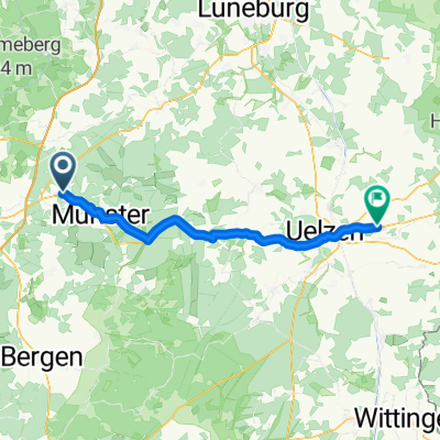
 Von Munster bis Lüneburg
- Distance
- 48.4 km
- Ascent
- 289 m
- Descent
- 353 m
- Location
- Munster, Lower Saxony, Germany
 Munster Bad Bodenteich 57 km
- Distance
- 59 km
- Ascent
- 101 m
- Descent
- 120 m
- Location
- Munster, Lower Saxony, Germany
 Munsteraner Runde incl 20 km DSA
- Distance
- 28 km
- Ascent
- 86 m
- Descent
- 87 m
- Location
- Munster, Lower Saxony, Germany
 Saisonfinale_2014
- Distance
- 7.1 km
- Ascent
- 41 m
- Descent
- 40 m
- Location
- Munster, Lower Saxony, Germany
 04_Munster - Bahnhof Lüneburg
- Distance
- 54.6 km
- Ascent
- 336 m
- Descent
- 395 m
- Location
- Munster, Lower Saxony, Germany
 Volksrafahren-Munster-2013
- Distance
- 54.4 km
- Ascent
- 136 m
- Descent
- 136 m
- Location
- Munster, Lower Saxony, Germany
 03_Müden (Örtze): Was mag sich unter den Hügeln verbergen?
- Distance
- 75 km
- Ascent
- 376 m
- Descent
- 376 m
- Location
- Munster, Lower Saxony, Germany
 Munster - Rätzlingen
- Distance
- 52.2 km
- Ascent
- 204 m
- Descent
- 235 m
- Location
- Munster, Lower Saxony, Germany
Open it in the app