

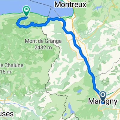
Lac d'Emosson via Vallée du Trient
A cycling route starting in Martigny-Ville, Valais, Switzerland.
Overview
About this route
Terrific alternate route to Lac d'Emosson. includes fabulous gravel trail stretch - marked on map.
Ride details here- -:--
- Duration
- 48.3 km
- Distance
- 1,666 m
- Ascent
- 1,669 m
- Descent
- ---
- Avg. speed
- ---
- Max. altitude

Route quality
Waytypes & surfaces along the route
Waytypes
Road
16.9 km
(35 %)
Quiet road
13.3 km
(28 %)
Surfaces
Paved
7.1 km
(15 %)
Unpaved
9.9 km
(20 %)
Unpaved (undefined)
9.9 km
(20 %)
Asphalt
7.1 km
(15 %)
Undefined
31.3 km
(65 %)
Route highlights
Points of interest along the route
Point of interest after 10.5 km
Gravel Trail begins
Point of interest after 13.5 km
Gravel Trail ends
Point of interest after 22.1 km
Tunnel
Continue with Bikemap
Use, edit, or download this cycling route
You would like to ride Lac d'Emosson via Vallée du Trient or customize it for your own trip? Here is what you can do with this Bikemap route:
Free features
- Save this route as favorite or in collections
- Copy & plan your own version of this route
- Sync your route with Garmin or Wahoo
Premium features
Free trial for 3 days, or one-time payment. More about Bikemap Premium.
- Navigate this route on iOS & Android
- Export a GPX / KML file of this route
- Create your custom printout (try it for free)
- Download this route for offline navigation
Discover more Premium features.
Get Bikemap PremiumFrom our community
Other popular routes starting in Martigny-Ville
![[Martigny_000] Col de la Croix de Cœur.](https://media.bikemap.net/routes/7803337/staticmaps/in_cdd017ee-75fd-46e2-a0ec-c59e19bcda56_400x400_bikemap-2021-3D-static.png) [Martigny_000] Col de la Croix de Cœur.
[Martigny_000] Col de la Croix de Cœur.- Distance
- 69.2 km
- Ascent
- 1,694 m
- Descent
- 1,695 m
- Location
- Martigny-Ville, Valais, Switzerland
 Alpencross 2007/1 - Martigny/CH bis Aosta/I
- Distance
- 89.2 km
- Ascent
- 2,705 m
- Descent
- 2,584 m
- Location
- Martigny-Ville, Valais, Switzerland
 Belle montée, peu de voitures
- Distance
- 20.4 km
- Ascent
- 975 m
- Descent
- 38 m
- Location
- Martigny-Ville, Valais, Switzerland
 Martigny-Thollon
- Distance
- 69.9 km
- Ascent
- 1,891 m
- Descent
- 1,444 m
- Location
- Martigny-Ville, Valais, Switzerland
 Forclaz backroad - Champex Lac - Col des Planches / Col du Lein
- Distance
- 102 km
- Ascent
- 3,119 m
- Descent
- 3,118 m
- Location
- Martigny-Ville, Valais, Switzerland
 Colonel
- Distance
- 214.5 km
- Ascent
- 3,599 m
- Descent
- 3,601 m
- Location
- Martigny-Ville, Valais, Switzerland
 Martigny nach Oberwald
- Distance
- 138.3 km
- Ascent
- 2,322 m
- Descent
- 1,411 m
- Location
- Martigny-Ville, Valais, Switzerland
 Etape 4 : Martigny - Station de Verbier (Tour de Suisse, Aramis) 40 km
- Distance
- 40.5 km
- Ascent
- 2,293 m
- Descent
- 653 m
- Location
- Martigny-Ville, Valais, Switzerland
Open it in the app