

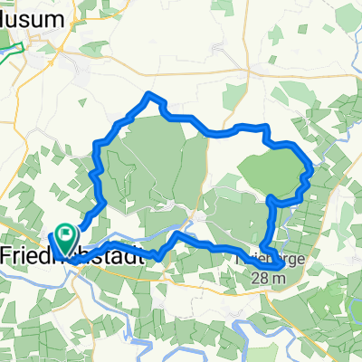
Eider-Treene-Sorge Weg
A cycling route starting in Friedrichstadt, Schleswig-Holstein, Germany.
Overview
About this route
The 240 km long Eider-Treene-Sorge cycle route runs on a circular course through the largest lowland area of Schleswig-Holstein. Rivers, meadows, forests, moors, and canals shape the landscape of this region. Between the towns of Husum, Heide, Schleswig, and Rendsburg, the route winds through intact, untouched nature along riverbanks that provide an ideal habitat for rare animal and plant species. In the small villages with their thatched half-timbered houses, time seems to stand still. Here, in the heart of Schleswig-Holstein, you will find peace and relaxation and experience a fascinating natural scenery from your bicycle.
- -:--
- Duration
- 233.2 km
- Distance
- 184 m
- Ascent
- 187 m
- Descent
- ---
- Avg. speed
- ---
- Max. altitude

Route quality
Waytypes & surfaces along the route
Waytypes
Quiet road
121.2 km
(52 %)
Track
72.3 km
(31 %)
Surfaces
Paved
74.6 km
(32 %)
Unpaved
30.3 km
(13 %)
Asphalt
46.6 km
(20 %)
Paved (undefined)
14 km
(6 %)
Continue with Bikemap
Use, edit, or download this cycling route
You would like to ride Eider-Treene-Sorge Weg or customize it for your own trip? Here is what you can do with this Bikemap route:
Free features
- Save this route as favorite or in collections
- Copy & plan your own version of this route
- Split it into stages to create a multi-day tour
- Sync your route with Garmin or Wahoo
Premium features
Free trial for 3 days, or one-time payment. More about Bikemap Premium.
- Navigate this route on iOS & Android
- Export a GPX / KML file of this route
- Create your custom printout (try it for free)
- Download this route for offline navigation
Discover more Premium features.
Get Bikemap PremiumFrom our community
Other popular routes starting in Friedrichstadt
 Nordsee 13a: Friedrichstadt-Halebüll 51,1km 0hm
- Distance
- 51.1 km
- Ascent
- 24 m
- Descent
- 24 m
- Location
- Friedrichstadt, Schleswig-Holstein, Germany
 Friedrichstadt-Schwabstedt 18,6 km
- Distance
- 18.6 km
- Ascent
- 10 m
- Descent
- 12 m
- Location
- Friedrichstadt, Schleswig-Holstein, Germany
 NF 001: Tönning - Schleswig - Tönning
- Distance
- 125.3 km
- Ascent
- 130 m
- Descent
- 127 m
- Location
- Friedrichstadt, Schleswig-Holstein, Germany
 Nordsee 13: Friedrichstadt-Tellingstedt 70,4km 80hm
- Distance
- 70.4 km
- Ascent
- 139 m
- Descent
- 126 m
- Location
- Friedrichstadt, Schleswig-Holstein, Germany
 Dagebüll - Heide - Elmshorn
- Distance
- 223.8 km
- Ascent
- 77 m
- Descent
- 73 m
- Location
- Friedrichstadt, Schleswig-Holstein, Germany
 Friedrichstadt-St-Peter-Ording-Küste
- Distance
- 49.9 km
- Ascent
- 4 m
- Descent
- 8 m
- Location
- Friedrichstadt, Schleswig-Holstein, Germany
 Friedrichstadt
- Distance
- 44.7 km
- Ascent
- 51 m
- Descent
- 54 m
- Location
- Friedrichstadt, Schleswig-Holstein, Germany
 Deutschland R2
- Distance
- 754.5 km
- Ascent
- 817 m
- Descent
- 697 m
- Location
- Friedrichstadt, Schleswig-Holstein, Germany
Open it in the app