

Rund um den Hohen Trauchberg
A cycling route starting in Saulgrub, Bavaria, Germany.
Overview
About this route
Start at the Parkhotel in Bad Bayersoien (the trail export has moved the start and finish to the Wies Church - this is also possible). Via Saulgrub, Altenau to Unternogg on the 'Bodensee - Königssee' cycle path. From the parking lot at Hengstbach, follow the well-marked mountain bike trail 'Rund um den Hohen Trauchberg' (sometimes there's only a signpost to Trauchgau). Only at one point must the bike be carried for a few meters. From the watershed (Ammer-Lech) it goes downhill - caution on the gravel and occasional car traffic! The signage does not go via the Wies Church, but back to Altenau.
To avoid having to descend into the Ammer valley and climb back up (from Morgenbach via Soyermühle and Grundbauer to Bayersoien), you can use the Eschelsbacher Bridge (70 m above the Ammer!) and, in good weather, freshen up beforehand at Lake Schwaigsee.
- -:--
- Duration
- 56.2 km
- Distance
- 737 m
- Ascent
- 736 m
- Descent
- ---
- Avg. speed
- ---
- Max. altitude
Route quality
Waytypes & surfaces along the route
Waytypes
Track
30.9 km
(55 %)
Quiet road
19.1 km
(34 %)
Surfaces
Paved
32 km
(57 %)
Unpaved
20.8 km
(37 %)
Asphalt
31.4 km
(56 %)
Gravel
17.4 km
(31 %)
Continue with Bikemap
Use, edit, or download this cycling route
You would like to ride Rund um den Hohen Trauchberg or customize it for your own trip? Here is what you can do with this Bikemap route:
Free features
- Save this route as favorite or in collections
- Copy & plan your own version of this route
- Sync your route with Garmin or Wahoo
Premium features
Free trial for 3 days, or one-time payment. More about Bikemap Premium.
- Navigate this route on iOS & Android
- Export a GPX / KML file of this route
- Create your custom printout (try it for free)
- Download this route for offline navigation
Discover more Premium features.
Get Bikemap PremiumFrom our community
Other popular routes starting in Saulgrub
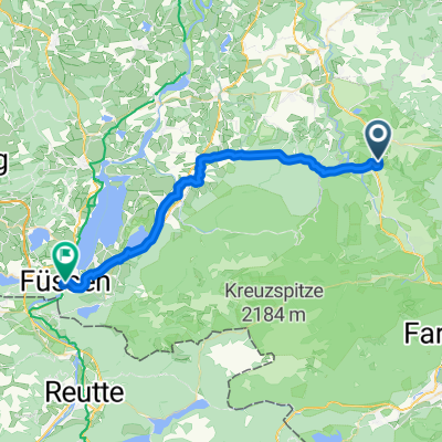 Saulgrub - Füssen
- Distance
- 35.1 km
- Ascent
- 382 m
- Descent
- 460 m
- Location
- Saulgrub, Bavaria, Germany
 Drei Schlösser
- Distance
- 105.5 km
- Ascent
- 1,320 m
- Descent
- 1,349 m
- Location
- Saulgrub, Bavaria, Germany
 Ammergebirge-Rundfahrt
- Distance
- 105.6 km
- Ascent
- 601 m
- Descent
- 601 m
- Location
- Saulgrub, Bavaria, Germany
 Tour 4
- Distance
- 14.6 km
- Ascent
- 327 m
- Descent
- 328 m
- Location
- Saulgrub, Bavaria, Germany
 unternogg
- Distance
- 43.5 km
- Ascent
- 784 m
- Descent
- 578 m
- Location
- Saulgrub, Bavaria, Germany
 Soinersee-Deutensee přes Wildsteig
- Distance
- 39.9 km
- Ascent
- 334 m
- Descent
- 336 m
- Location
- Saulgrub, Bavaria, Germany
 Soierensee-Staffelsee
- Distance
- 38.3 km
- Ascent
- 457 m
- Descent
- 464 m
- Location
- Saulgrub, Bavaria, Germany
 Soierensee-Staffelsee
- Distance
- 38.3 km
- Ascent
- 439 m
- Descent
- 442 m
- Location
- Saulgrub, Bavaria, Germany
Open it in the app