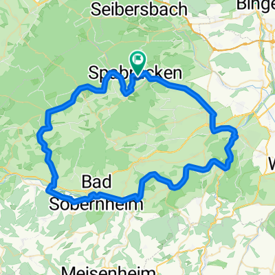
Mittlere Soonwaldrunde
A cycling route starting in Spabrücken, Rhineland-Palatinate, Germany.
Overview
About this route
Von Tiefenbach nach Argenthal geht ein schöner Radweg, teils im TalÂ
- -:--
- Duration
- 44.1 km
- Distance
- 808 m
- Ascent
- 738 m
- Descent
- ---
- Avg. speed
- 642 m
- Avg. speed
Route quality
Waytypes & surfaces along the route
Waytypes
Busy road
26.9 km
(61 %)
Quiet road
5.3 km
(12 %)
Surfaces
Paved
32.2 km
(73 %)
Unpaved
1.5 km
(3 %)
Asphalt
29.2 km
(66 %)
Paved (undefined)
2.4 km
(5 %)
Continue with Bikemap
Use, edit, or download this cycling route
You would like to ride Mittlere Soonwaldrunde or customize it for your own trip? Here is what you can do with this Bikemap route:
Free features
- Save this route as favorite or in collections
- Copy & plan your own version of this route
- Sync your route with Garmin or Wahoo
Premium features
Free trial for 3 days, or one-time payment. More about Bikemap Premium.
- Navigate this route on iOS & Android
- Export a GPX / KML file of this route
- Create your custom printout (try it for free)
- Download this route for offline navigation
Discover more Premium features.
Get Bikemap PremiumFrom our community
Other popular routes starting in Spabrücken
- Tour aus Langeweile
- Distance
- 73.7 km
- Ascent
- 503 m
- Descent
- 699 m
- Location
- Spabrücken, Rhineland-Palatinate, Germany
- Mittlere Soonwaldrunde
- Distance
- 44.1 km
- Ascent
- 808 m
- Descent
- 738 m
- Location
- Spabrücken, Rhineland-Palatinate, Germany
- Spabrücker Rundfahrt
- Distance
- 72 km
- Ascent
- 1,097 m
- Descent
- 1,086 m
- Location
- Spabrücken, Rhineland-Palatinate, Germany
- Der Umweg zum Zelten
- Distance
- 104.7 km
- Ascent
- 1,191 m
- Descent
- 1,367 m
- Location
- Spabrücken, Rhineland-Palatinate, Germany
- Der weg zur Arbeit
- Distance
- 24 km
- Ascent
- 29 m
- Descent
- 295 m
- Location
- Spabrücken, Rhineland-Palatinate, Germany
- Kleines Training
- Distance
- 11.9 km
- Ascent
- 193 m
- Descent
- 185 m
- Location
- Spabrücken, Rhineland-Palatinate, Germany
- Kellenbach Runde
- Distance
- 70.7 km
- Ascent
- 1,018 m
- Descent
- 1,093 m
- Location
- Spabrücken, Rhineland-Palatinate, Germany
- Wallhausen über Hergenfeld
- Distance
- 13.2 km
- Ascent
- 203 m
- Descent
- 208 m
- Location
- Spabrücken, Rhineland-Palatinate, Germany
Open it in the app