

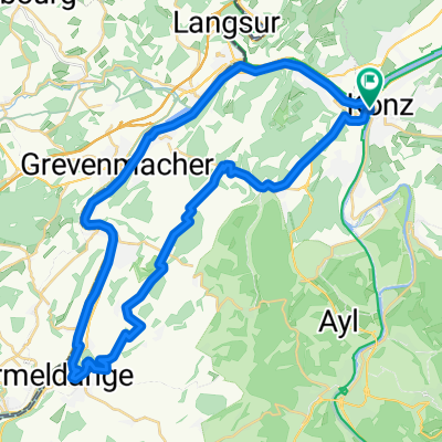
140722, 1. Etappe, Konz-Thionville
A cycling route starting in Konz, Rhineland-Palatinate, Germany.
Overview
About this route
Typical of the Moselle in Germany, Luxembourg and France
- -:--
- Duration
- 73.2 km
- Distance
- 242 m
- Ascent
- 219 m
- Descent
- ---
- Avg. speed
- ---
- Max. altitude

Route quality
Waytypes & surfaces along the route
Waytypes
Path
24.9 km
(34 %)
Access road
13.2 km
(18 %)
Surfaces
Paved
62.2 km
(85 %)
Asphalt
56.4 km
(77 %)
Paved (undefined)
5.9 km
(8 %)
Undefined
11 km
(15 %)
Continue with Bikemap
Use, edit, or download this cycling route
You would like to ride 140722, 1. Etappe, Konz-Thionville or customize it for your own trip? Here is what you can do with this Bikemap route:
Free features
- Save this route as favorite or in collections
- Copy & plan your own version of this route
- Sync your route with Garmin or Wahoo
Premium features
Free trial for 3 days, or one-time payment. More about Bikemap Premium.
- Navigate this route on iOS & Android
- Export a GPX / KML file of this route
- Create your custom printout (try it for free)
- Download this route for offline navigation
Discover more Premium features.
Get Bikemap PremiumFrom our community
Other popular routes starting in Konz
 Lustige Fahrt auf schlechten Straßen CLONED FROM ROUTE 154394
- Distance
- 33.8 km
- Ascent
- 365 m
- Descent
- 273 m
- Location
- Konz, Rhineland-Palatinate, Germany
 D 025: Konz - Saarbrücken
- Distance
- 92.8 km
- Ascent
- 256 m
- Descent
- 201 m
- Location
- Konz, Rhineland-Palatinate, Germany
 Luxemburger Ecke
- Distance
- 71.9 km
- Ascent
- 477 m
- Descent
- 477 m
- Location
- Konz, Rhineland-Palatinate, Germany
 3 flüsse
- Distance
- 66.5 km
- Ascent
- 793 m
- Descent
- 795 m
- Location
- Konz, Rhineland-Palatinate, Germany
 8-Konz-Pelm-91km-1350Hm
- Distance
- 91.1 km
- Ascent
- 1,488 m
- Descent
- 1,231 m
- Location
- Konz, Rhineland-Palatinate, Germany
 140722, 1. Etappe, Konz-Thionville
- Distance
- 73.2 km
- Ascent
- 242 m
- Descent
- 219 m
- Location
- Konz, Rhineland-Palatinate, Germany
 13.08.09 Pfalzel-Merzig
- Distance
- 108.9 km
- Ascent
- 679 m
- Descent
- 689 m
- Location
- Konz, Rhineland-Palatinate, Germany
 Konz - Wincheringen (alternativ)
- Distance
- 41.6 km
- Ascent
- 411 m
- Descent
- 412 m
- Location
- Konz, Rhineland-Palatinate, Germany
Open it in the app