

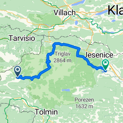
Bovec, Vrsic, Tarvisio, Predil, Bovec
A cycling route starting in Bovec, Občina Bovec, Slovenia.
Overview
About this route
bell'anello al confine tra Italia e Slovenia con 2 passi
- -:--
- Duration
- 95.4 km
- Distance
- 1,704 m
- Ascent
- 1,704 m
- Descent
- ---
- Avg. speed
- ---
- Max. altitude

Route quality
Waytypes & surfaces along the route
Waytypes
Busy road
85.2 km
(89 %)
Quiet road
7.1 km
(7 %)
Surfaces
Paved
91.2 km
(96 %)
Unpaved
0.3 km
(<1 %)
Asphalt
89.1 km
(93 %)
Paved (undefined)
2.1 km
(2 %)
Continue with Bikemap
Use, edit, or download this cycling route
You would like to ride Bovec, Vrsic, Tarvisio, Predil, Bovec or customize it for your own trip? Here is what you can do with this Bikemap route:
Free features
- Save this route as favorite or in collections
- Copy & plan your own version of this route
- Split it into stages to create a multi-day tour
- Sync your route with Garmin or Wahoo
Premium features
Free trial for 3 days, or one-time payment. More about Bikemap Premium.
- Navigate this route on iOS & Android
- Export a GPX / KML file of this route
- Create your custom printout (try it for free)
- Download this route for offline navigation
Discover more Premium features.
Get Bikemap PremiumFrom our community
Other popular routes starting in Bovec
 Bovec zahodna pot
- Distance
- 18.3 km
- Ascent
- 338 m
- Descent
- 334 m
- Location
- Bovec, Občina Bovec, Slovenia
 Julijska tura: Na Mangart
- Distance
- 11.6 km
- Ascent
- 1,029 m
- Descent
- 146 m
- Location
- Bovec, Občina Bovec, Slovenia
 Ziua a doua
- Distance
- 125.8 km
- Ascent
- 4,185 m
- Descent
- 4,170 m
- Location
- Bovec, Občina Bovec, Slovenia
 Von Bovec bis Tolmein
- Distance
- 38.6 km
- Ascent
- 768 m
- Descent
- 1,047 m
- Location
- Bovec, Občina Bovec, Slovenia
 Kobariski Stol MTB
- Distance
- 85.5 km
- Ascent
- 1,817 m
- Descent
- 2,477 m
- Location
- Bovec, Občina Bovec, Slovenia
 Heimweg
- Distance
- 24.2 km
- Ascent
- 546 m
- Descent
- 750 m
- Location
- Bovec, Občina Bovec, Slovenia
 Ziua a doua scurt
- Distance
- 83.7 km
- Ascent
- 2,525 m
- Descent
- 2,511 m
- Location
- Bovec, Občina Bovec, Slovenia
 Route to Gostilna Pri Stefanu
- Distance
- 43.9 km
- Ascent
- 910 m
- Descent
- 1,196 m
- Location
- Bovec, Občina Bovec, Slovenia
Open it in the app