

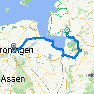
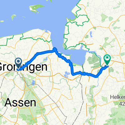
Rondje Noord-Drenthe
A cycling route starting in Groningen, Province of Groningen, The Netherlands.
Overview
About this route
The route runs from Hoogkerk, via Peize, Donderen, Peest, Norg, Steenbergen, Roden and Roderwolde back to Hoogkerk, but of course you can join anywhere.
- -:--
- Duration
- 59.7 km
- Distance
- 20 m
- Ascent
- 20 m
- Descent
- ---
- Avg. speed
- ---
- Max. altitude
Route quality
Waytypes & surfaces along the route
Waytypes
Quiet road
25.1 km
(42 %)
Cycleway
22.1 km
(37 %)
Surfaces
Paved
44.1 km
(74 %)
Unpaved
3.6 km
(6 %)
Asphalt
29.8 km
(50 %)
Concrete
14.3 km
(24 %)
Continue with Bikemap
Use, edit, or download this cycling route
You would like to ride Rondje Noord-Drenthe or customize it for your own trip? Here is what you can do with this Bikemap route:
Free features
- Save this route as favorite or in collections
- Copy & plan your own version of this route
- Sync your route with Garmin or Wahoo
Premium features
Free trial for 3 days, or one-time payment. More about Bikemap Premium.
- Navigate this route on iOS & Android
- Export a GPX / KML file of this route
- Create your custom printout (try it for free)
- Download this route for offline navigation
Discover more Premium features.
Get Bikemap PremiumFrom our community
Other popular routes starting in Groningen
 Rondje Lauwerzijl 56 km
- Distance
- 55.6 km
- Ascent
- 6 m
- Descent
- 6 m
- Location
- Groningen, Province of Groningen, The Netherlands
 Groningen - Glimmen - Eelde - Groningen
- Distance
- 27.6 km
- Ascent
- 37 m
- Descent
- 37 m
- Location
- Groningen, Province of Groningen, The Netherlands
 42 km Rondom Zuidlaardermeer
- Distance
- 42 km
- Ascent
- 14 m
- Descent
- 14 m
- Location
- Groningen, Province of Groningen, The Netherlands
 NiederlandeReferenzstrecke
- Distance
- 29 km
- Ascent
- 6 m
- Descent
- 7 m
- Location
- Groningen, Province of Groningen, The Netherlands
 Groningen - Weener
- Distance
- 107.8 km
- Ascent
- 52 m
- Descent
- 52 m
- Location
- Groningen, Province of Groningen, The Netherlands
 2025-09-25 - Groningen - Farmsum - Bad Nieuweschans - Leer
- Distance
- 99.7 km
- Ascent
- 282 m
- Descent
- 284 m
- Location
- Groningen, Province of Groningen, The Netherlands
 Groningen nach Emmen
- Distance
- 68.6 km
- Ascent
- 220 m
- Descent
- 232 m
- Location
- Groningen, Province of Groningen, The Netherlands
 Groningen - Papenbg- Oldbg - Lesum 190 KM
- Distance
- 186.2 km
- Ascent
- 47 m
- Descent
- 26 m
- Location
- Groningen, Province of Groningen, The Netherlands
Open it in the app