

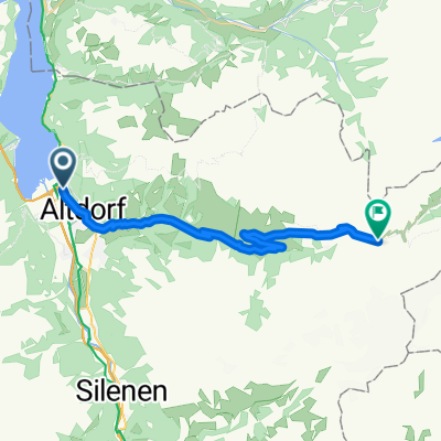
Flüelen - Klausenpass - Klöntal - Flüelen
A cycling route starting in Flüelen, Canton of Uri, Switzerland.
Overview
About this route
Flüelen - Klausen Pass - Klöntal - Flüelen
- -:--
- Duration
- 129.8 km
- Distance
- 2,679 m
- Ascent
- 2,681 m
- Descent
- ---
- Avg. speed
- ---
- Max. altitude
Route quality
Waytypes & surfaces along the route
Waytypes
Road
29.9 km
(23 %)
Quiet road
9.1 km
(7 %)
Surfaces
Paved
110.3 km
(85 %)
Unpaved
7.8 km
(6 %)
Asphalt
106.4 km
(82 %)
Gravel
3.9 km
(3 %)
Continue with Bikemap
Use, edit, or download this cycling route
You would like to ride Flüelen - Klausenpass - Klöntal - Flüelen or customize it for your own trip? Here is what you can do with this Bikemap route:
Free features
- Save this route as favorite or in collections
- Copy & plan your own version of this route
- Split it into stages to create a multi-day tour
- Sync your route with Garmin or Wahoo
Premium features
Free trial for 3 days, or one-time payment. More about Bikemap Premium.
- Navigate this route on iOS & Android
- Export a GPX / KML file of this route
- Create your custom printout (try it for free)
- Download this route for offline navigation
Discover more Premium features.
Get Bikemap PremiumFrom our community
Other popular routes starting in Flüelen
 CH07_Rund um den Vierwaldstätter See
- Distance
- 73.6 km
- Ascent
- 620 m
- Descent
- 625 m
- Location
- Flüelen, Canton of Uri, Switzerland
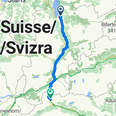
 Klausenpass Westseite
- Distance
- 26.8 km
- Ascent
- 1,626 m
- Descent
- 101 m
- Location
- Flüelen, Canton of Uri, Switzerland
 2016 6 Trier - Gotthardpass
- Distance
- 50.8 km
- Ascent
- 1,681 m
- Descent
- 35 m
- Location
- Flüelen, Canton of Uri, Switzerland
 Fluelen -Gotthard Pass Faido National Route 3
- Distance
- 82.7 km
- Ascent
- 1,687 m
- Descent
- 1,382 m
- Location
- Flüelen, Canton of Uri, Switzerland
 Flüelen - Klausenpass - Klöntal - Flüelen
- Distance
- 129.8 km
- Ascent
- 2,679 m
- Descent
- 2,681 m
- Location
- Flüelen, Canton of Uri, Switzerland
 Flüelen-Andermatt-Oberalppass-Sargans 165km, 2170hm
- Distance
- 164.9 km
- Ascent
- 1,867 m
- Descent
- 1,826 m
- Location
- Flüelen, Canton of Uri, Switzerland
 EV5: Flüelen to Bauen
- Distance
- 4.6 km
- Ascent
- 222 m
- Descent
- 184 m
- Location
- Flüelen, Canton of Uri, Switzerland
 jgjgh
jgjgh- Distance
- 206.2 km
- Ascent
- 5,980 m
- Descent
- 4,656 m
- Location
- Flüelen, Canton of Uri, Switzerland
Open it in the app