

Jósvafő-Sk
A cycling route starting in Rudabánya, Borsod-Abauj Zemplen county, Hungary.
Overview
About this route
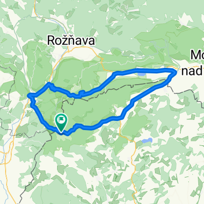
Jósvafő - Pelsőc - Szilice - Szádalmás - Tonanádaska - Szín
- -:--
- Duration
- 99.7 km
- Distance
- 727 m
- Ascent
- 728 m
- Descent
- ---
- Avg. speed
- ---
- Max. altitude

Continue with Bikemap
Use, edit, or download this cycling route
You would like to ride Jósvafő-Sk or customize it for your own trip? Here is what you can do with this Bikemap route:
Free features
- Save this route as favorite or in collections
- Copy & plan your own version of this route
- Split it into stages to create a multi-day tour
- Sync your route with Garmin or Wahoo
Premium features
Free trial for 3 days, or one-time payment. More about Bikemap Premium.
- Navigate this route on iOS & Android
- Export a GPX / KML file of this route
- Create your custom printout (try it for free)
- Download this route for offline navigation
Discover more Premium features.
Get Bikemap PremiumFrom our community
Other popular routes starting in Rudabánya
 Poprad - Eger 4. deň
- Distance
- 98.4 km
- Ascent
- 969 m
- Descent
- 1,040 m
- Location
- Rudabánya, Borsod-Abauj Zemplen county, Hungary
 SZLOVÁKIA 1
- Distance
- 93.2 km
- Ascent
- 636 m
- Descent
- 632 m
- Location
- Rudabánya, Borsod-Abauj Zemplen county, Hungary
 OKT Gömöri Kék 2
- Distance
- 22.4 km
- Ascent
- 512 m
- Descent
- 506 m
- Location
- Rudabánya, Borsod-Abauj Zemplen county, Hungary
 Aggtelek 5.
- Distance
- 23.7 km
- Ascent
- 139 m
- Descent
- 262 m
- Location
- Rudabánya, Borsod-Abauj Zemplen county, Hungary
 Szelce kör
- Distance
- 34.2 km
- Ascent
- 353 m
- Descent
- 355 m
- Location
- Rudabánya, Borsod-Abauj Zemplen county, Hungary
 Jósvafő-Kutató - Tornakápolna - Teresznye - Égerszög - Béke-bg - Baradla-tanösvény - Baradla-tető - Baradla-bg-Jósvafő - Kutató
- Distance
- 36.2 km
- Ascent
- 851 m
- Descent
- 851 m
- Location
- Rudabánya, Borsod-Abauj Zemplen county, Hungary
 Aggtelek-Szlovák Karszt körtúra I.
- Distance
- 94.3 km
- Ascent
- 647 m
- Descent
- 649 m
- Location
- Rudabánya, Borsod-Abauj Zemplen county, Hungary
 2. kerékpáros túra - 3. etap
- Distance
- 78.5 km
- Ascent
- 195 m
- Descent
- 406 m
- Location
- Rudabánya, Borsod-Abauj Zemplen county, Hungary
Open it in the app