

Donau-Radweg: Mühlheim-Sigmaringen
A cycling route starting in Kolbingen, Baden-Wurttemberg, Germany.
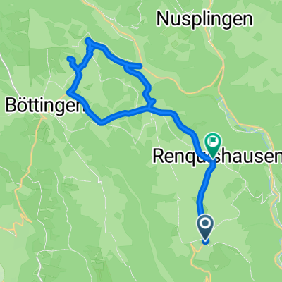
Overview
About this route
You ride through the Danube Gorge and probably the most beautiful part of your journey. Between Fridingen and Beuron, no car or train disturbs the joy of cycling, and the Abbey of Beuron invites you to rest. Amidst towering limestone cliffs, still crowned by some castles or ruins, the river and the cycling path wind their way to Sigmaringen, the former capital of the eponymous principality. In the still-inhabited residential castle, an interesting guided tour and an extensive collection of weapons await you. (cloned from route 19)
- -:--
- Duration
- 46.9 km
- Distance
- 354 m
- Ascent
- 421 m
- Descent
- ---
- Avg. speed
- ---
- Max. altitude
Route quality
Waytypes & surfaces along the route
Waytypes
Track
24.9 km
(53 %)
Path
11.3 km
(24 %)
Surfaces
Paved
30.5 km
(65 %)
Unpaved
16 km
(34 %)
Asphalt
25.8 km
(55 %)
Gravel
11.7 km
(25 %)
Continue with Bikemap
Use, edit, or download this cycling route
You would like to ride Donau-Radweg: Mühlheim-Sigmaringen or customize it for your own trip? Here is what you can do with this Bikemap route:
Free features
- Save this route as favorite or in collections
- Copy & plan your own version of this route
- Sync your route with Garmin or Wahoo
Premium features
Free trial for 3 days, or one-time payment. More about Bikemap Premium.
- Navigate this route on iOS & Android
- Export a GPX / KML file of this route
- Create your custom printout (try it for free)
- Download this route for offline navigation
Discover more Premium features.
Get Bikemap PremiumFrom our community
Other popular routes starting in Kolbingen
 Kleine Heubergrunde für wenig Zeit
- Distance
- 23.8 km
- Ascent
- 425 m
- Descent
- 389 m
- Location
- Kolbingen, Baden-Wurttemberg, Germany
 Malcesine
- Distance
- 498 km
- Ascent
- 3,307 m
- Descent
- 4,080 m
- Location
- Kolbingen, Baden-Wurttemberg, Germany
 Runde über den großen Heuberg
- Distance
- 62.1 km
- Ascent
- 762 m
- Descent
- 762 m
- Location
- Kolbingen, Baden-Wurttemberg, Germany
 Heuberg_Hegau Runde
- Distance
- 86.3 km
- Ascent
- 693 m
- Descent
- 692 m
- Location
- Kolbingen, Baden-Wurttemberg, Germany
 2024 - D - Tag 1 - Mühlheim - Sigmaringendorf
- Distance
- 54.5 km
- Ascent
- 1,205 m
- Descent
- 1,269 m
- Location
- Kolbingen, Baden-Wurttemberg, Germany
 Donautal- Heuberg Runde mit netten Höhen
- Distance
- 69.2 km
- Ascent
- 947 m
- Descent
- 941 m
- Location
- Kolbingen, Baden-Wurttemberg, Germany
 Klein aber oho
- Distance
- 22 km
- Ascent
- 469 m
- Descent
- 582 m
- Location
- Kolbingen, Baden-Wurttemberg, Germany
 Heuber Runde
- Distance
- 65.6 km
- Ascent
- 679 m
- Descent
- 674 m
- Location
- Kolbingen, Baden-Wurttemberg, Germany
Open it in the app