

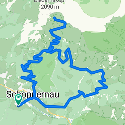
Damüls mit Pass
A cycling route starting in Schoppernau, Vorarlberg, Austria.
Overview
About this route
Schoppernau - Au - Damüls Pass and back
- -:--
- Duration
- 53.4 km
- Distance
- 1,628 m
- Ascent
- 1,627 m
- Descent
- ---
- Avg. speed
- ---
- Max. altitude
Route quality
Waytypes & surfaces along the route
Waytypes
Track
27.3 km
(51 %)
Quiet road
6.4 km
(12 %)
Surfaces
Paved
27.3 km
(51 %)
Unpaved
25.7 km
(48 %)
Asphalt
27.3 km
(51 %)
Gravel
18.7 km
(35 %)
Continue with Bikemap
Use, edit, or download this cycling route
You would like to ride Damüls mit Pass or customize it for your own trip? Here is what you can do with this Bikemap route:
Free features
- Save this route as favorite or in collections
- Copy & plan your own version of this route
- Sync your route with Garmin or Wahoo
Premium features
Free trial for 3 days, or one-time payment. More about Bikemap Premium.
- Navigate this route on iOS & Android
- Export a GPX / KML file of this route
- Create your custom printout (try it for free)
- Download this route for offline navigation
Discover more Premium features.
Get Bikemap PremiumFrom our community
Other popular routes starting in Schoppernau
 Radweg Bregenzerwald | Schoppernau - Doren - Geokoordinaten (Route)
- Distance
- 39.3 km
- Ascent
- 68 m
- Descent
- 448 m
- Location
- Schoppernau, Vorarlberg, Austria
 Egg - Formarinsee
- Distance
- 55.6 km
- Ascent
- 2,123 m
- Descent
- 1,514 m
- Location
- Schoppernau, Vorarlberg, Austria
 Diedamskopf Profitour
- Distance
- 26.7 km
- Ascent
- 1,390 m
- Descent
- 1,390 m
- Location
- Schoppernau, Vorarlberg, Austria
 Damüls mit Pass
- Distance
- 53.4 km
- Ascent
- 1,628 m
- Descent
- 1,627 m
- Location
- Schoppernau, Vorarlberg, Austria
 Unterdorf 229–278, Schoppernau to Rathausstraße 15, Bregenz
- Distance
- 55.1 km
- Ascent
- 1,234 m
- Descent
- 1,670 m
- Location
- Schoppernau, Vorarlberg, Austria
 Radweg Bregenzerwald | Schoppernau - Doren - Radweg Bregenzerwald | Schoppernau - Doren
- Distance
- 39.3 km
- Ascent
- 67 m
- Descent
- 447 m
- Location
- Schoppernau, Vorarlberg, Austria
 Lindau München Teil 2
- Distance
- 156.6 km
- Ascent
- 2,341 m
- Descent
- 2,294 m
- Location
- Schoppernau, Vorarlberg, Austria
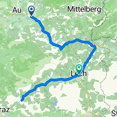
 Schoppernau-Auenfeld-Spullersee-Lech
- Distance
- 43.9 km
- Ascent
- 2,106 m
- Descent
- 1,457 m
- Location
- Schoppernau, Vorarlberg, Austria
Open it in the app