

Hautacam jakoo juli 2014
A cycling route starting in Pierrefitte-Nestalas, Occitanie, France.
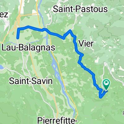
Overview
About this route
First, we cycled the Tourmalet. On the way back to our campsite (in St Jean de Luz), we passed by the start point for the Hautacam. Of course, we couldn’t just ride past it. It was a wonderful ride, less touristy than the Tourmalet. Unfortunately, the weather was against us: rain, mist, and even a bit of thunderstorm. The descent was wet and cold, but with a piece of cardboard on the chest, it was manageable. Next time, I’ll bring a jacket.
- -:--
- Duration
- 14.8 km
- Distance
- 45 m
- Ascent
- 1,142 m
- Descent
- ---
- Avg. speed
- ---
- Max. altitude
Route quality
Waytypes & surfaces along the route
Waytypes
Road
14.6 km
(99 %)
Undefined
0.1 km
(1 %)
Surfaces
Paved
0.3 km
(2 %)
Asphalt
0.3 km
(2 %)
Undefined
14.5 km
(98 %)
Continue with Bikemap
Use, edit, or download this cycling route
You would like to ride Hautacam jakoo juli 2014 or customize it for your own trip? Here is what you can do with this Bikemap route:
Free features
- Save this route as favorite or in collections
- Copy & plan your own version of this route
- Sync your route with Garmin or Wahoo
Premium features
Free trial for 3 days, or one-time payment. More about Bikemap Premium.
- Navigate this route on iOS & Android
- Export a GPX / KML file of this route
- Create your custom printout (try it for free)
- Download this route for offline navigation
Discover more Premium features.
Get Bikemap PremiumFrom our community
Other popular routes starting in Pierrefitte-Nestalas
 Tourmalet
- Distance
- 99.3 km
- Ascent
- 3,100 m
- Descent
- 3,100 m
- Location
- Pierrefitte-Nestalas, Occitanie, France
 *09-D. Pierrefitte-Nestalas - Superbagneres (128 Km)
- Distance
- 128 km
- Ascent
- 5,034 m
- Descent
- 3,708 m
- Location
- Pierrefitte-Nestalas, Occitanie, France
 Cauterets, port d'Espagne
- Distance
- 17.9 km
- Ascent
- 1,070 m
- Descent
- 89 m
- Location
- Pierrefitte-Nestalas, Occitanie, France
 Artalens Commute
- Distance
- 17.8 km
- Ascent
- 525 m
- Descent
- 511 m
- Location
- Pierrefitte-Nestalas, Occitanie, France
 Tour de France 08, Étape 10: Pau - Hautacam
- Distance
- 98.9 km
- Ascent
- 2,346 m
- Descent
- 2,346 m
- Location
- Pierrefitte-Nestalas, Occitanie, France
 TA21-5
- Distance
- 144.9 km
- Ascent
- 3,452 m
- Descent
- 3,126 m
- Location
- Pierrefitte-Nestalas, Occitanie, France
 2014 Ride Day 40 - Artalens to Saint-Gaudens
- Distance
- 104.4 km
- Ascent
- 798 m
- Descent
- 1,259 m
- Location
- Pierrefitte-Nestalas, Occitanie, France
 Day 3 - Coast to Coast
- Distance
- 107.1 km
- Ascent
- 3,028 m
- Descent
- 2,863 m
- Location
- Pierrefitte-Nestalas, Occitanie, France
Open it in the app