

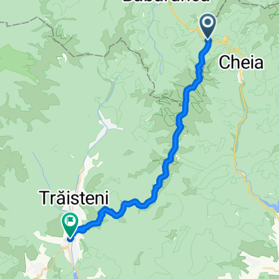
Asaltul Grohotis: din Cheia la baraj Paltinul (Valea Doftana)
A cycling route starting in Crivina, Brașov County, Romania.
Overview
About this route
A doua zi vom porni din nou la drum, pe un traseu usor diferit, spre Cheia. Traseul nu are variatii mari de altitudine, suie constant, perfect pentru inceput de sezon. (cloned from route 1993383)
- -:--
- Duration
- 33.6 km
- Distance
- 680 m
- Ascent
- 1,267 m
- Descent
- ---
- Avg. speed
- ---
- Max. altitude

Route quality
Waytypes & surfaces along the route
Waytypes
Track
25.5 km
(76 %)
Path
6 km
(18 %)
Surfaces
Paved
2 km
(6 %)
Unpaved
25.5 km
(76 %)
Ground
25.2 km
(75 %)
Asphalt
2 km
(6 %)
Route highlights
Points of interest along the route
Point of interest after 2.3 km
Varianta de intrare in traseu (scurtare) - direct din Cheia.
Continue with Bikemap
Use, edit, or download this cycling route
You would like to ride Asaltul Grohotis: din Cheia la baraj Paltinul (Valea Doftana) or customize it for your own trip? Here is what you can do with this Bikemap route:
Free features
- Save this route as favorite or in collections
- Copy & plan your own version of this route
- Sync your route with Garmin or Wahoo
Premium features
Free trial for 3 days, or one-time payment. More about Bikemap Premium.
- Navigate this route on iOS & Android
- Export a GPX / KML file of this route
- Create your custom printout (try it for free)
- Download this route for offline navigation
Discover more Premium features.
Get Bikemap PremiumFrom our community
Other popular routes starting in Crivina
 TURA CIUCAS
- Distance
- 35.6 km
- Ascent
- 1,606 m
- Descent
- 1,607 m
- Location
- Crivina, Brașov County, Romania
 Route RO > Siriu Mountains
- Distance
- 99.2 km
- Ascent
- 2,779 m
- Descent
- 2,615 m
- Location
- Crivina, Brașov County, Romania
 Varful Ciucas prin Valea Berii
- Distance
- 5.1 km
- Ascent
- 756 m
- Descent
- 67 m
- Location
- Crivina, Brașov County, Romania
 Asaltul Grohotis: din Cheia la baraj Paltinul (Valea Doftana)
- Distance
- 33.6 km
- Ascent
- 680 m
- Descent
- 1,267 m
- Location
- Crivina, Brașov County, Romania
 Vama Buzaului - Zimbrarie - Zizin - Brasov
- Distance
- 63.7 km
- Ascent
- 336 m
- Descent
- 559 m
- Location
- Crivina, Brașov County, Romania
 Muntii Grohotisului
- Distance
- 19.3 km
- Ascent
- 702 m
- Descent
- 510 m
- Location
- Crivina, Brașov County, Romania
 Muntii Grohotis - Pasul Bratocea - Valea Doftanei
- Distance
- 31.3 km
- Ascent
- 658 m
- Descent
- 1,149 m
- Location
- Crivina, Brașov County, Romania
 GrohotisMnt - BratoceaPass Peak ValeaDoftanei
- Distance
- 31.8 km
- Ascent
- 663 m
- Descent
- 1,241 m
- Location
- Crivina, Brașov County, Romania
Open it in the app