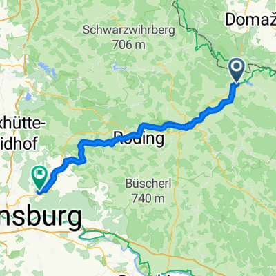
Furth im Wald - Wenzenbach
- 72.9 km
- 691 m
- 736 m
- Furth im Wald, Bavaria, Germany
A cycling route starting in Furth im Wald, Bavaria, Germany.
Overview
'From 'Furth i. W.' on the 'Glasstraße' via Eschlkamp to 'Neukirchen b. Hl. Blut'. From there, a steep climb at Kolmstein. After descending to Engelshütt, continue to Lohberghütte. Along the 'Lam-Winkel-Arber-Radweg', continue on paved road to Sommerau, then to the parking lot below the Small Arbersee. Turnoff to the 'Mooshütte' and onwards to 'Brennes' (pass) on forest trail (steep, long climbs!). From Brennes, descend past the Great Arber towards the Great Arbersee on a moderately trafficked route. Then a steep climb towards Bodenmais via the 'Bretterschachen' (pass). Descend on a moderately trafficked route to Bodenmais, heading towards Zwiesel via Langdorf towards 'Brandten'.
created this 16 years ago
Continue with Bikemap
You would like to ride 2009/08/17 von Furth i. W. über den Gr. Arber ins Brandter Tal (b. Zwiesel) or customize it for your own trip? Here is what you can do with this Bikemap route:
Free trial for 3 days, or one-time payment. More about Bikemap Premium.
Discover more Premium features.
Get Bikemap PremiumFrom our community
Open it in the app