

sortie09082014
A cycling route starting in Ahun, Nouvelle-Aquitaine, France.
Overview
About this route
<table border="0" cellpadding="0" cellspacing="0" style="width:896px;" width="896"> <tbody> <tr> <td nowrap="nowrap" style="width:896px;height:21px;">
Rond- Point des usines à Lannemezan – Avezac gare – Capvern – Mauvezin – Abbaye d’Escaladieu - D 938 en face – Prochain R.Point à Gauche </td> </tr> <tr> <td nowrap="nowrap" style="width:896px;height:20px;"> D 938 – Haut de la cote – A gauche D 784 – COL DES PALOMIERES – Au refuge des chasseurs (chez Loulou) à Gauche D 584 – Lies – A droite petite </td> </tr> <tr> <td nowrap="nowrap" style="width:896px;height:20px;"> route (laubruchou) direction Esconnets – (petite route Tuco de Puyo, Cot Det Hôo) – D 684 Espieilh – D684 / D 84 Bourg de Bigorre </td> </tr> <tr> <td nowrap="nowrap" style="width:896px;height:20px;"> – D 14 Moulins des Baronnies – D 14 - A Gauche D 82 Tilhouse – Sur D938 à Droite Rond-point des Usines. </td> </tr> </tbody></table>
- -:--
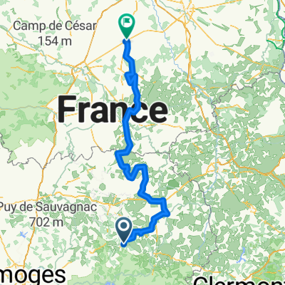
- Duration
- 403.4 km
- Distance
- 2,371 m
- Ascent
- 2,322 m
- Descent
- ---
- Avg. speed
- ---
- Max. altitude
Continue with Bikemap
Use, edit, or download this cycling route
You would like to ride sortie09082014 or customize it for your own trip? Here is what you can do with this Bikemap route:
Free features
- Save this route as favorite or in collections
- Copy & plan your own version of this route
- Split it into stages to create a multi-day tour
- Sync your route with Garmin or Wahoo
Premium features
Free trial for 3 days, or one-time payment. More about Bikemap Premium.
- Navigate this route on iOS & Android
- Export a GPX / KML file of this route
- Create your custom printout (try it for free)
- Download this route for offline navigation
Discover more Premium features.
Get Bikemap PremiumFrom our community
Other popular routes starting in Ahun
 Moutier d'Ahun
- Distance
- 10.3 km
- Ascent
- 200 m
- Descent
- 200 m
- Location
- Ahun, Nouvelle-Aquitaine, France
 Merde
Merde- Distance
- 194.7 km
- Ascent
- 692 m
- Descent
- 1,114 m
- Location
- Ahun, Nouvelle-Aquitaine, France
 aubusson
- Distance
- 43.5 km
- Ascent
- 659 m
- Descent
- 659 m
- Location
- Ahun, Nouvelle-Aquitaine, France
 aubusson
- Distance
- 44.1 km
- Ascent
- 663 m
- Descent
- 666 m
- Location
- Ahun, Nouvelle-Aquitaine, France
 sortie09082014
- Distance
- 403.4 km
- Ascent
- 2,371 m
- Descent
- 2,322 m
- Location
- Ahun, Nouvelle-Aquitaine, France
 dimanchsoir
- Distance
- 4.2 km
- Ascent
- 60 m
- Descent
- 63 m
- Location
- Ahun, Nouvelle-Aquitaine, France
 De Rue Principale 4, Saint-Avit-le-Pauvre à Place de L Hôtel de ville 6769, Boussac
- Distance
- 50.2 km
- Ascent
- 608 m
- Descent
- 824 m
- Location
- Ahun, Nouvelle-Aquitaine, France
 1ere étape tour de la ciate 2011
- Distance
- 83.7 km
- Ascent
- 778 m
- Descent
- 781 m
- Location
- Ahun, Nouvelle-Aquitaine, France
Open it in the app